Wednesday, 28 August 2019

The TransRockies Run


The TransRockies Run
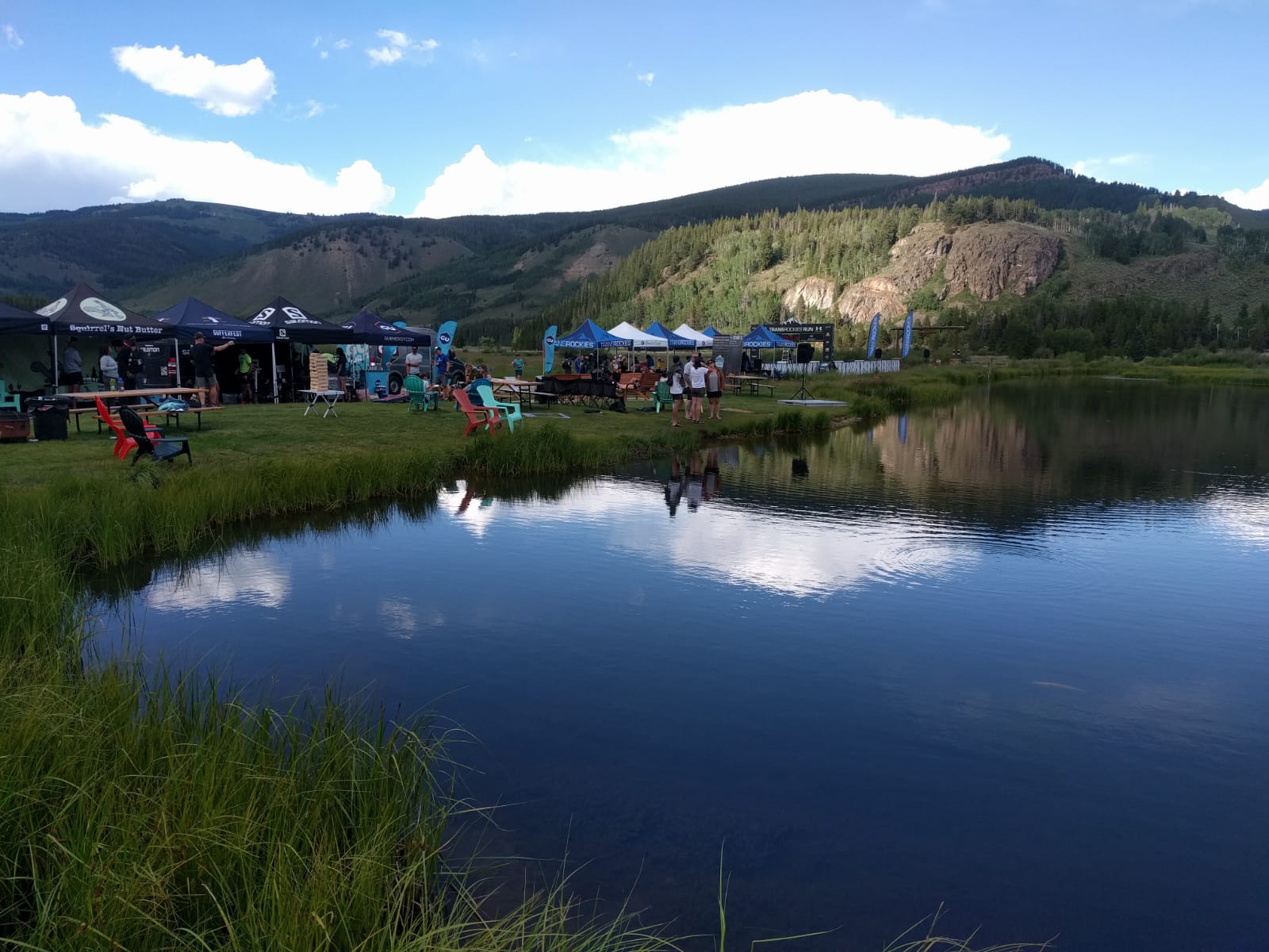
After a few weeks back at work, I was off on my running travels again, though this time across the pond to what seemed like a gentleman's version of my multiday events. The TransRockies Run is a 6 day run covering 120miles with 20,000 feet of elevation gain, but you do not have to carry all your kit with you. Tents are set up every day by a camp team, there is a recovery area in the camp serving unlimited snacks and beers, there are often places to go to buy lunch such as a nearby town/pub/BBQ, a shower truck is at camp every afternoon/night and breakfast + dinner are unlimited selfservice buffets. For those that don't even want this level of slumming it (you can also pay extra for an individual tent rather than sharing with another person), a hotel option is available (though those doing this seemed to have very early transfers back to the campsite for breakfast in the morning!!). I had heard about the TRR several years ago, but thought it was a pairs event so discounted it as who would put up with running with me for 6 days on the trot??!!! A bit of research this year showed me that there are actually very few pairs in the event and most people run it individually. I thought the Rockies would be a beautiful places to visit/run and so was sold!!
My number for the week
Acclimatising in Boulder for a day
The one thing I hadn't really factored in was the altitude. On landing at Denver airport, you are already higher than Ben Nevis, and this is still well below the lowest point of the race. A little jog and some sightseeing in downtown Boulder the next day left me puffing and panting and wondering what on earth I'd signed myself up for, especially as everyone on the shuttles (that took us on the 3 hour drive to the race start/registration at Buena Vista) seemed to be a seasoned altitude/ultrarunner!


Day 1

Everyone ready for the off...
This was the "easy intro day" as it was at a lower level (the start at Buena Vista was at 8000feet and the highest point was 9500feet) and we didn't have to carry mandatory kit. However, it was to be our first day of 6, and was reported to be the hottest, sunniest and driest day of the week which would pose its own challenges. We had chosen to camp at the Day 1 evening camp, so although we had to source our own breakfast prior to the bus to the start, we didn't have to pack up all our belongings....so again we were "eased" into the event.

With Catriona at the start
The route map showed that the run would be approx 22miles (I learnt over the week that distances were often "slightly" longer than advised) with 3000feet of elevation gain, and we had been advised that gaiters were recommended for the sand. Having run across deserts, I didn't think the sand in the Colorado mountains would be that bad, so didn't bother with gaiters...which seemed to be the right decision on the day. At registration, I had chatted to Catriona, a lass who originally hailed from Edinburgh (so we found that we had several running friends in common) but now lives in Arizona. She was doing the 3 day option and having done so the previous year, advised me that there was no need to carry a pack on day 1. I put my sunnies on my head and just took a waterbottle with me, so was rather perturbed to see her carrying a small vest when I met her on the start line - eek!!!

The fact that it was a long multiday event seemed to make no difference to the start, with some people haring off along the road, but maybe they had the right idea, as I was much nearer the back than the front when we started climbing up the singletrack trail. I managed to pass several people on the first climb, but was also nearly pushed off the edge of the trail by a man desperate to get past me and cut in "so that he could be next to his team mate" (I wanted to point out that it was a 2minute rule for teammate separation not 2cm but I held my tongue......well, that and the fact I didn't have much breath to spare).

The climb eased off and we turned onto a forestry road, so I managed a brief chat to a couple of runners going a similar pace to me before we split up again as we got higher and higher. I had hoped to have been able to run the whole of the first day, but I had had a few short walking breaks on the steeper inclines before I got to CP1 (at the high point). The sun was out and beating down very strongly, and I did feel rather hot and bothered, as well as short of breath. Unusually, I had finished my whole drinks bottle by the time I got to the CP, so I filled it up, poured some water over my head, took some snacks, thanked the marshals and set off again.

A long downhill let everything settle down again and I made up some more places, but everyone seemed to find it a long way to the next CP, as there were another couple of steep climbs, albeit much shorter, but it was now much hotter. I had no idea what was happening up ahead of me in the field, but I was just happy to be out running in such beautiful scenery, that I wouldn't have really cared what position I was in (well, I say that, but in the top 10 of the ladies' field would have been nice!). I was toing and froing with another lady all the way up to CP2 (though I found out later that she was in the 3day event, so we weren't even in the same category for results!) but on the descent from there I seemed to drop her. I was quite surprised to be still moving up the field as I ran downhill, but then again, I had started a long way back, and the descents weren't very technical.

Being "encouraged" by a fellow Brit!
CP3 seemed to be on the valley floor with just a rough road to run along to the finish. The marshals at CP3 offered me "chips, fireball or PBJ"....and not having much clue what they were talking about, I opted for "fireball".....never again, as this turned out to be a shot of cinnamon whisky :-( Eurgh....it took a lot of watermelon and jelly babies to clear my palate from that!! I'd been told that it was 3.5miles to the finish from there, and although I was rather hot, I thought I could just about make it, so my heart sank when the marshals told me that it was actually 5 miles. That road seemed to go on forever....and I learnt later that it wasn't the flat road that it seemed, as it gradually climbed the whole way. Just as I'd given up and was slowing to walk, another expat Brit encouraged me to keep going as the finish was just ahead (as it turned out - 4 miles from the last CP).
 
The Day 1 Podium!
I was over the moon to cross the line and tuck into more snacks and drink...before venturing down to the nearby river for a paddle (it was freezing and I certainly wasn't brave enough to go for full immersion). A bus then shuttled people back to Camp for showers, beers, a rest, a chat, the Stage awards, and our daily local history lesson. I was amazed to find that I'd finished as 3rd open female (so earning myself a handmade wooden stage medal), and so decided that I could just rest on my laurels for the rest of the week....as I'd already surpassed all of my pre-run expectations!!


Day 2

Morning views at camp
At first glance, this would seem an easier day, being only 13.5miles long and finishing with a shuttle transfer to the campground in town, where there were plenty of friendly cafes etc.....but the elevation gain over those few miles was to be 3200feet, with most of those climbed on a 2.5mile trail. We had to be up early to pack everything away so the tents could come down, and then boarded some old schoolbuses to go to the start. I was so keen on getting as many calories (and hot coffee) in as possible that I only just left the breakfast tent in time to catch the last shuttle. We wound up and up on smaller and smaller roads (so steep that the driver daren't stop for anyone to have a toilet break) to the startline at the Vicksburg (at almost 9700feet we were starting higher than the highest point on the previous day's run!!).

Climbing up to Hope Pass
The first mile and a half was a very gentle climb along a gravel road, and it didn't feel too bad, but then we turned sharply onto a singletrack and that's where the suffering started. It was about 2.5miles from there to the top of Hope Pass (12,600feet) but it seemed a lot longer. Don't get me wrong, it was an absolutely beautiful trail that climbed up through trees, across rocky screes and then up the open hillside, but I felt like I smoked 40/day and had lead for legs. On the lower sections, many people passed me going about twice my speed, but later on, we were a lot more spread out and I actually gained a place or two back. The view from the summit was amazing and I took a moment to appreciate it (though this time I knew enough to decline the fireball that the marshals there offered me), before heading down the (for me) dreaded descent.
Over The Top.....

The first mile of the descent was rather steep and rocky (with an added twist of a slippery snowfield to cross), but then I really enjoyed the next section down below the treeline. A couple of men careened past as I braked a lot more than them, but I was actually enjoying looking round at the scenery and views rather than running hard and looking at my feet/the floor. It was one of the most beautiful woodland trails I have run on!

Along the lakeshore
On reaching the lakeshore the path flattened and I picked up my pace, as I'd been running out of sight of anyone for a while and was slightly worried that I'd gone off trail. The lake (well there were two lakes one after the other) were absolutely stunning as they came in and out of view between the trees, but I couldn't work out why every slight bump in the trail felt like a mountain. then it dawned on me that although I might have felt as if I was running along my local trails at home, I was still actually at an altitude of over 9200feet). Once my addled brain figured this out, I relaxed, stopped struggling on the inclines and reeled in several runners who'd passed me earlier. The second lake seemed like one of those optical illusions - you never got to the end of it, as each corner opened up into another expanse, but eventually I spied the finish gantry and crossed it secure in the knowledge that there were shuttles to take us to Leadville (for showers, beers, a rest and ice cream shops!!).


Day 3

This was the longest day - at almost 25miles - and took us from civilisation (in Leadville), to a beautiful wilderness camp at Nova Guides where there were no other people and no phone reception. It was the last day for those doing the shorter version of the event, and though I envied them at times (usually on a long boring drag), I was actually really enjoying being out in such a beautiful part of the world.

Beautiful flowers even at altitude
The first couple of miles were on tarmac, starting right in the centre of Leadville, but even they undulated (it felt like there was a small mountain in the road within the first 500m!), so I managed to chat to Tyler (a lovely lady from California who was always a position ahead of me at the end of the day!) for a bit as we eased into our running. We soon turned off onto a 4WD track to climb steeply up the largest climb of the day, but after a while I had to ease back slightly from her pace, but it helped me to just keep her in sight (well until she ran away off the summit that is!).

I couldn't ever complain about the views
More climbing and descending took us into our first ski resort of the race, though it did seem very small and rather ghost-town like in the summer, but then again I only really ran across large empty parking areas. Shortly afterwards, we crossed the highway onto the Continental Divide and I joined forces with a guy called Ryan as we enjoyed scooting along the singletrack of the Continental Divide National scenic Trail. I had only had a few brief chats to Ryan on the previous 2 days as we passed each other back and forth, but this time, we stuck together for quite a long period and so he told me about where he came from (Boulder....so I reckoned the altitude must be easy for him!) and the YouTube videos that he makes of various races (I was rather alarmed when he swung his gopro at me and started recording!).

After we crossed the railway and entered a more rough/rooty/wooded section, I had a slight flag and lost him. In a way this which was rather fortuitous as I then tripped up and did a silly stumble/flail/trip/fall on the least technical section and so only had to suffer the embarrassment of a hiker asking me if I was OK, as he passed in the opposite direction (yes, I twisted a knee slightly, but it was mainly my ego that had been dented by the witnessed rubbish pirouette). The trail descended out of the woods and hit a CP on the gravel flats by Camp Hale (and old military training/PoW camp). The volunteers there asked me what I would like, and I joked that I would absolutely love a gin and tonic. To my surprise, by the time I'd grabbed some snacks and refilled my water bottles, I was handed a plastic cup filled with actual G&T. I tasted it....and it was perfect.....they definitely get my vote as the best CP vollies :-)

Woohoo - another podium placing
The next lady appeared behind me (she was leading the 3 day race) and thought me crazy for offering her some so I finished it myself, thanked them kindly and set off again. We had been warned that we needed a special mental toughness for those last 3 miles of gravel, especially as you can see the camp, but appear to have to head way beyond it before circling back....but having been fuelled by the G&T, I didn't find it so bad. In fact I managed to chase down a couple of guys that had previously been out of sight....and just ran out of race before catching the next few, though apparently I managed another 3rd place in this stage too.

Camp wasn't bad either!!!
Not a bad view for the Chill Out Zone
The camp was so worth the gravel...it was stunning...the tents were set up by an idyllic lake (in which we saw musk rats swimming) and there was even freshly BBQed food on sale to hungry runners who needed decent sustenance before dinner! That evening's entertainment also included a version of a beer "mile" (involving necking cans of the race sponsor beer and running reps on the first section of gravel road), which people had obviously prepared for in advance, as they turned up to run in either fancy dress, or swimming gear!

Day 4

Day 4 Start
The way we were about to run out of camp
We did seem a little depleted in number for the start of Day 4 as although some of the 3 Dayers came out to cheers us off, others had gone home, or were having more of a lie in (mind you, nights aren't exactly short when it's cold and dark as soon as the sun sets). This was going to be another shorter (15 miles) steeper (2800 feet of climb) day but reached a slightly lower altitude than Day 2, topping out at just under 12,000 feet. The start was back on the undulating gravel roads from the end of the previous day, but after a couple of miles we turned off onto a jeep track which climbed up Hornsilver Mountain. This track got steeper and steeper, and I have no idea how anybody would possibly dare take a jeep up there. There had been landslides which stopped vehicles going up (and hence we had to carry extra water etc), but even so, it would be a braver soul than me that risked driving up (and even more so down) that trail. As it was, everyone ended up with their hands on their knees plodding up (Ok so I was forced to admit that those with poles had a definite advantage again, but I manfully struggled on alone).
Worth the climb to see the mountains


Running along the ridge...
It was an absolute delight to reach the top of the climb, as the summit ridge stretched out for a couple of miles and the views were stunning. The footing was good and the altitude meant that it was only possible to run at a "sightseeing pace", so enabling me to appreciate both the views of the Mount of the Holy Cross and other rocky, snowy peaks surrounding me. All good things come to and end.....and it was soon time to start the long descent down towards Wearyman Creek. At first I managed to keep up with the guys I'd caught on the summit ridge but as the route got steeper and rockier, I instinctively slowed down and then didn't seem anyone for what seemed like forever. I figured that I really must have gone the wrong way as I'd been descending for over 3 miles, but finally another lady (Anna) came down and flew past, commenting on how long the descent was. I could hear splashes from the creek a long time before I saw it, but finally I was there....in it, getting my feet wet.

The route description mentioned about half a mile of creek, but in the previous night's briefing, they'd said that it was actually much longer (due to the excess snowfall and then melt in the past few months) - and that you couldn't avoid getting your feet wet in the chilly water. I seemed to be in and out of it after only a few metres, and hardly felt the temperature of it so couldn't see what the fuss was about....but then I rounded a corner and saw that I'd just had a tiny taster of what was to come.
Despite my lack of poles, I didn't feel that unstable both in the water and rock hopping along the banks....so I soon caught Anna (who did have poles and couldn't understand how I was managing without any) up and dragged her with me past a couple of guys who were floundering around. There seemed to be a few photographers around that stretch, so they must have been expecting some funny pictures as the water was freezing cold and did reach my knees on occasion.

Chilling with Anna
The last CP was just after we exited the stream, and I grabbed something to eat and drink whilst Anna powered on towards the finish. It was a weird sensation to be running down the dirt road from that CP, as my feet were totally numb from the cold water so I felt they must be slapping down all over the place. After the tough climb and descent, I felt more in my element now, so shot past Anna again and over the next last couple of miles another man came into view ahead of me. I caught him as we hit the edge of Red Cliff and we then had a sprint finish through town to the line outside Mango's pub. I waited for Anna and we got a shuttle back to camp, sorted our tents, had a shower and then returned to Mango's on another shuttle....and joined in the finish line festivities, cheering other runners in whilst drinking Margaritas on the deck! Not a bad way to finish a run :-)
Day 5

Typical single track later in the day
 We were shuttled back from camp to Mangos ready to start the penultimate day......a mere 24ish miles with 4100feet of elevation gain. The run started back up the dirt road we'd come down the evening before.....but continued on up the valley past yesterday's stream exit point/CP. Most of it was runnable but I knew there was a lot of climbing ahead so I decided to walk some of the early steeper portions. Anna was powering on today and although we started at a similar pace, she was less inclined to walk and so soon moved ahead, though remained within my sight for several miles. A few is the slower paced participants had started about an hour ahead of us, and I caught up to one lady after about 6 or 7 miles. She was moving quite slowly and resting on her poles fairly frequently, so I stopped to ask if she was ok. She looked rather cyanosed (her lips had a lovely blue tinge) and she was weaving a bit but declined any support or help. I ran on to a photographer I saw, but he didn't have a radio to alert the medical team. I debated going back to accompany her, but doubted what good I could do so carried on to a hairpin in the road where there were some supporters. They said they would contact the race organisers and the medical team and I pushed my own pace harder than I wanted to, as the CP was less than half a mile up the road. 

More "rubbish" views between the trees
On arriving there, I first had to catch my breath and slow my heart rate down, but then I spoke to the medics and relayed my observations and they jumped in the car to go down the road to her (I asked how she was later in the day and heard that she was ok......she had been like that on several occasions but always insisted on continuing further than advised to they kept a stern watch over her). There was little else that I could do, but I still felt rather guilty for continuing on my way......typical medic eh?


Mtn bike tracks
Higher and higher....
That CP was the point where we turned off the dirt road onto some beautiful single track that climbed up further through the forest. The trail was deceptive as you'd think you'd reached the highest point and start descending, only to hit another steep climb and end up above where you'd just been. There were a few mountain bike trails to cross (and mountain bikers to avoid) but eventually I found myself on the wide open meadows above Vail ski resort. It was stunning as you were either running between copses of aspen trees or through open expanses of wild flowers. I did fear that I'd gone the wrong way as I saw no other runners for ages, but I didn't really care as it was such stunning scenery. Once I'd made it into the ski resort territory I did spy a man ahead of me, and we eventually ended up running along together traversing the ridge. 
A friendly "marshal" by the CP

Flailing my way into the CP
The day's briefing had included a description of a "very technical section dropping through a cliff band"  but when I got there I was amazed at the description as it was such a short section, and the route itself was so tame compared to paths in the Lake District or the Scottish hills. The next CP was being guarded by friendly marmots, but I didn't stay long to admire them and soon headed off again. I'd thought that my new running mate and I would probably stick together for the next section, as we continued to undulate along the ridgeline on a mix of double track and gravel roads, but I was definitely moving the quicker of the pair of us. I thought I would be overtaken by many runners as I dropped off down the ski hill on a twisty rough single track section, but in fact, it was just me catching people ahead of me, both those that had started at the same time as me and some of the early starters, though by this point it was impossible to tell who was who.
Starting the descent to Vail
At the final CP of the day, they told me that it was a mere 5 miles to the finish, and it was almost all downhill on (dirt) ski access roads. These weren't "too" steep and so I was in my element. I flew down the hill at about 7 minute mile pace, passing all the rest of the early starters (and indeed a few of the others.....differentiated at this point by their relative speeds). There were many long switchbacks on that road....and I spotted the two ladies ahead of me as tiny little figures way down below (about 4 switchbacks ahead the first time I spotted them). I put them to the back of my mind and just kept pushing on as my legs were turning over nicely.....but I just ran out of race that day. I ended up coming into the Vail Athletic Fields less than a minute behind them both and they were kind enough to say that if we'd had another few hundred metres to go, I'd have caught them. That definitely gave me some confidence as my "broken legs" hadn't given me much grief and I seemed to be able to run OK as long as we were at a lower altitude.....happy days!

Day 6

The last day of this event was very different from the previous ones I have taken part in, as they all finished with a short run which, as positions had already been determined and were unlikely to change, we all tended to treat as sociable fun runs where you can chat with friends you have made over the week. The TransRockies was rather the opposite, as the final day was one of the longest (at about 23 miles) and had the most climbing in it (5200 feet of elevation gain). I have to say that I would much rather have had a shorter chatty run out as I was rather "over it" by this stage and just looking forward to finishing, but as we were going from the Vail ski fields to the smaller, posher resort of Beaver Creek, I had no doubt that the scenery would be fantastic!

Leaving Vail
The start was earlier than usual (I presume that this was to ensure that everyone finished successfully in time to either head home or attend the final banquet dinner) but breakfast was the same as every other day 😂......I'd actually become rather a creature of habit over the week, as I had developed a daily routine of rising, dressing, packing, eating and setting off. I met up with Tyler before the start - she'd had a bad day and been ill, so I offered to run with her so that we could both just complete the distance, but she urged me to run on my own and move up onto the podium. We waved goodbye to the tents for the final time and headed off at 7am - initially along the pavement of the road we'd run into camp along, but then back up onto the ski access tracks above town.
Just wow!!!

We dropped back into Vail and crossed over the interstate by way of an overpass, ran alongside it for a short period and then headed up into the hills. As soon as we left the tarmac, we were on the single track of Vail's North Trail. Despite the early start, it was already very hot as we wound up and up the hillside, so I was very glad of shady patches in which to cool off. I enjoyed the steady climb up another few trails to reach the high point of the day (at almost 10,500 feet) 11 miles in. 

Through the trees.....
I knew the descent back down Buck Creek was a fairly long one, but I hadn't expected 5 miles of it. I ran alone for a long way, surprised not to be overtaken but I did a fairly good job of talking to myself to ensure I didn't forget to pick my feet up on the rougher sections, and to just relax when the trail was completely overgrown with grass and plants. There's only so long I can do that before I start to doubt myself and so slow down and start worrying that I've either gone the wrong way, or that I'm about to fall base over apex. When this happened, I did finally see other runners......initially Anna, who said she loved the downhills on the course, and then a few guys who were rather keen for me to stop completely and leave the trail in order for them to pass. Hmmm......but at least I knew I was still going the right way.

Eventually I passed under the road, carried on descending, crossed the creek I'd been tracking and then climbed back up to the road.....where there was a very welcome CP (and water/snack point), though unfortunately they did not have the ice cream that I was craving. From there it was a lovely mile downhill on tarmac into town and so I just let my legs go and chased a couple of guys back down again. The "short" section through the town of Avon seemed to go on for ever with little ups and downs and I got through all the water that I'd filled my bottle with at the last CP as the sun was so strong.

Finishing with Richard for silly pics!
A week's swag!
Finally, I made it to the final CP, just at the top of Avon, where the trail headed back onto single track that wound up another climb of about 1000feet. I ate, drank and filled up then headed off towards that long awaited finish. The climb must have been not much longer than 3 miles but it was a toughie. I chatted to mountain bikers that were resting in the shade and even managed to beg some water from a photographer on the course (well he offered me a drink as he saw me heading off to a nearby trickle having already finished my bottle). I almost caught Anna on that climb, as although I found it tough, I was now climbing better than those around me (I put about 20 minutes into some guys I passed soon after the CP and they were leading their pairs category), but suddenly I popped out onto a gravel access road and started the steep (mile long) downhill run in to the finish. A wooden footbridge guided you across the main road and towards the ski lifts, but just as you thought you had to climb again, the gantry appeared overhead and it was all over!

The all-conquering British runners!
The final podium
Anna and I chatted over beers at the finish and then I waited for Tyler to see her safely in, which goes to show what friends you make over the course of such events. I'd finished as 3rd lady, but the memories and friendships I'd made were worth much more than my prize of a buff......I guess it was a run of a lifetime, as I'd never run with day upon consecutive day of amazing mountain views before.....and so definitely one to remember!

Monday, 5 August 2019

The Swiss Irontrail


I ran the Swissalpine K78 in 2011 and 2012. Memory is a fickle thing, as we tend to forget/minimise any pain and suffering and just remember the good things. It was looking back with those rose-tinted spectacles that gave me the idea of running it again this year. I know I don't have so much speed and drive these days, but thought I'd like another good day out in the mountains, and I remember loving spending a few days in Davos in the run-up to the event.
 

Eek....the "new" route!
Unfortunately I did not look very closely at the details when I entered....I spotted that the name had changed to the "Irontrail" and it was now called the T88 instead of the K78....but as the event approached and I looked at the details more closely, I started to worry. Not only had the distance increased by a few kilometres, but it no longer started and finished in Davos (previously there had been a long, flat - well net downhill - run along the valley from Davos to Bergun, followed by a climb up and over the Sertig Pass and back to Davos) so I would now have to catch a train to St Moritz at 4am, and then climb more than 2.5X the elevation gain of the previous event (and descend even more). I think the fact that there was now a 24hr cutoff and compulsory kit to carry (including a headtorch with spare batteries) rather than it being a day run was a bit of a clue as to how much harder it would be.


The route elevation profile
My friend Richard had come out with me and was going to run his first "marathon" (the K43, which did actually start and finish in Davos and went up a valley, over the Sertig Pass and back to Davos), but he was entertained by how worried I was about the changes to the event. My big fear was that I wouldn't finish in daylight and I'd be running down mountains and through forests in the dark, but after we arrived in Davos, I developed new worries about the weather and the altitude. It was so hot....about 29-30 degrees during the week in Davos......and I would start at 1770m and climb 4 passes (2460 - 2780m) before finishing back in Davos at 1560m!!


Something the Swiss do very well, is that they include travel in the cost of a race entry - so not only did we get a lovely train trip up to the mountains, but we could also travel around the area (eg taking the train over to visit St Moritz one day and down to Klosters to try our hand at breadbaking in an outdoor oven on another day) - and the local tourist tax then lets you take lifts up and down the mountains (a bonus if you want great views and an attempt at a bit of  acclimatisation without exhausting your legs). This meant that despite my misgivings about the actual run, I really enjoyed having a few days up in the mountains, and the heat just made it more conducive to sitting outside eating ice cream and drinking cold beer whilst surrounded by amazing views. Whatever happened on race day, it was worth the trip and the unwinding from the stress of everyday life!


Taking the train from Davos to St Moritz
at a more sociable time of day earlier in
the week :-)
I found it very hard to sleep the night before the race, so my 3am alarm was rather redundant. Still, I crept around getting dressed and making porridge and coffee so as not to wake anyone else, and headed off to the station in Davos Platz. The racer organisers had put on a special 4am train for us to get to St Moritz (free with your race number), so I actually ended up sitting in the first class carriage. It was dark outside but the carriage lights were on full so I could neither sleep nor look at the views.....and so ended up snacking most of the way there. I heard little spoken except German (with a smattering of Italian), so couldn't really join in any conversations (not that I'm that sociable anyway!!). On arrival at St Moritz they had kindly opened up a couple of cafes, so there were places to keep warm after dropping off "finish" and "halfway" bags. It was starting to get light and the cloud was lifting up from the lake towards the mountains...beautiful!


Early morning mist rising above the lake
at St Moritz
Due to the number of runners, there were significant toilet queues and I found myself still waiting 5 minutes before the start. I cannot say that this stopped me from stressing as it probably added to it, but I finally made it over to the starting pen just as the 15 second countdown began. Suddenly we were off, running out of the station, down the road under the railway and onto the lakeside path. I had managed to do 2 lots of damage to my right knee the day before (once twisting it going up some steps, and once banging it off the corner of my bed) and it hurt as soon as I started running....so that I doubted whether I'd even make it round to the far side of the lake where we were due to head off into the woods.


I ignored it as much as I could...and then actually found that I'd forgotten about it as I was enjoying watching the mist lift up from the lake as the day dawned. By the time I reached the climb up away from the lake, it felt fine and I was starting to move up past people through the field. I didn't really feel much flow in my running, but I put that down to the altitude rather than any (ahem) lack of fitness/training. I tried to ignore some course markers I spotted (as they implied that I was near the end of a marathon....hence obviously for a different event) and just enjoy the trail as it undulated over the first hill and down to Pontresina.


The runnable valley floor section
I couldn't believe my ears as people called out that I was the first lady as I passed through Pontresina (surely they'd missed someone? or several people?) but I had little time to muse on this as the first of our big climbs started there. Pontresina is at 1805 so hardly above the height of St Moritz but we had to get up to Muottas Muragi at 2452 in the space of the next 5k, so although a lot of it was actually runnable, I admit that I did some walking rather early on in the event. We passed a hut on the summit and I grabbed a bar and a drink and faced the first dreaded descent. The next CP was at Samedan (1721m) and most of the height was lost in the next kilometre. The path was narrow, rooty and rocky, so although I tried to "run" down it, compared to everyone else I was practically strolling. A lady with poles flew past me and I only just managed to avoid getting stabbed, though I admired the ease with which she bombed down and out of sight. The descent seemed to go on forever, but finally I hit the valley floor and my pace picked up again. I chatted to a couple of guys as I caught them up, and we enjoyed the early morning temperatures and views.


Runners approaching Samedan
The CP at Samedan seemed to involve running through a large sportshall, after which I got lost trying to get out of the car park (I found myself roaming between parked cars and stumbling down a steep grassy bank in order to get back onto the actual course, but after that the views were familiar as we ran up the valley to Bever and then turned 90 degrees to the left along the route of the St Moritz-Davos trainline towards the Albulatunnel (it was tempting to jump on a train just before it went into the tunnel as the race route went over the top of the mountain range that the tunnel was carved through and we were to rejoin it on the other side. The sun had now been out all morning and the weather was really heating up, but as this stretch of wide trail was really runnable I caught up to the lady that had previously overtaken me. She kept looking back and seemed to be "running scared". I would always rather be behind someone than in front (well, not everyone obviously) but I was just moving a bit more quickly and didn't want to alter my speed so I tried to be polite and friendly as I passed by.


On rounding a corner in the trail, I almost fell over a water station and an arrow directing me off 90 degrees to the right....and straight up a hillside. After the first few metres this was definitely not runnable, and although  usually prefer ups to downs, I didn't enjoy this one right from the outset. Not only did I find it rather hot, and the direct sun rather strong, but I couldn't get my body to work up the steep slope. My legs felt like they had little power, and I couldn't settle my breathing into a rhythm. When the aforementioned lady powered on past me, there was little camaraderie as I had to jump off the singletrack trail to avoid having a pole through my foot. The handful of men that passed me were much more relaxed and friendly, and as for the next lady, Luzia, well, she went out of her way to give me advice on powerhiking. She lives in Davos and said that the mountains were her playground and I was so grateful for her encouragement. My problem was mainly altitude related as it felt like I had claudication in my legs. I have only seen this in more elderly vascular patients - pain in the muscles of the buttocks/legs due to limited blood supply - so it was rather weird (and not very pleasant) to experience it myself!!


The mountain trails were beautiful
It was only a couple of minutes after Luzia passed that I finally reached the high point (2462m), and was surprised to see the marshal there had "4 Deserts" patches on his sleeves. I really hadn't know what to expect - I guess I thought I'd be going straight down the other side to the trainline - but the trail undulated for some distance over a rocky plateau before dropping down steeply to the Bergun valley. I hadn't seen anyone for what seemed like a very long time (I guess there was no one close behind, and all those in front were much better descenders than me) when I caught up to a familiar looking male runner going through a gate across a farmyard. He immediately recognised me and reminded me of when we'd both run the Oman Desert race (what a small world it is).....but he seemed to be finding it a bit tougher than me, as though we initially stuck together and chatted, he soon dropped back.


The weather changed with alarming quickness, and by the time I reached the next CP (where I stopped for a wee while as there were both cakes and chocolate) I was already quite wet. I'm so glad that I still got out my waterproof jacket, as it significantly deteriorated after that. It could have been a lovely run down the valley but unfortunately the trail was only about a foot wide, and in many places was about a foot deep in water. I couldn't see what was underneath the muddy puddles so had to be rather more careful with my footing as there were rocks and roots hidden from sight. At times it was like running down a stream, and even the pretty sections through woods became a nervous slip/slide on wet pine needles and mud. I managed a couple of to and fro places with guys as I approached the lowest point on the route (1367m) but was over the moon to climb to the town of Bergun - the main aid station where there was hot food and drink, our drop bags, seats in a hall....and I could drop out and get the train back to Davos!


I was cheered into Bergun as the 3rd lady, but I myself was more cheered about the thought of getting in out of the rain, sitting down, eating and drinking something decent and looking through the contents of my drop bag :-)  I seriously debated calling it a day there, as I knew that I had to go over 2 more passes that were higher than anything I'd yet climbed, maxing out at 2738m (and as I'd already been struggling, I couldn't see that it would be much fun). However, after a can of redbull, a restock of my bags, some food (obviously including chocolate) and a look at the map, I decided to continue onwards. I thought that from Bergun onwards, the route would be the same as I'd done in 2011 and 2012 (I remembered some stunning scenery) and worked out that even if I walked the whole thing, I wouldn't finish too long after nightfall (we had until 6am on the Sunday to finish, but I didn't really fancy being out long after darkness set in at 9pm).


The local support was brilliant (even
when the heavens opened)
The next section consisted of a very long gravel forestry road that just seemed to wind up and up into the mountains. I was to and fro between 3rd and 4th places now but it was quite sociable as we chatted every time we passed each her (her moving more quickly on the steeper sections....aided by her poles, and me when it was flatter and more runnable). We also bumped into a guy that I'd been chatting to on the run into Samedan when we stopped and filled our bottles up in a large watertrough. The weather had changed again, so it was back to waterproofs off and tucked away in our packs. Either my memory failed me, or the route had significantly changed from the original K78 (I'd like to think the latter), as I was on the opposite side of the valley from the one I remembered. The company had really helped me, but I was moving more quickly than I felt I could sustain, so I let them disappear off ahead of me as I gasped my way higher and higher (though I did regret that when I had to work my way through herds of cows on my own).


I nearly cheered with relief (except that might have taken more breath than I had) when I saw the Keschhutte in relief on the mountain up ahead of me (as it marked the first of the 2 high passes), but then I almost cried with disappointment when I saw that the route did not go straight up to it, but first descended to a CP on the valley floor and then climbed back up the other side again. I felt like I was crawling up that last climb, and several men poled past (and a lady doing the second leg of the relay), but I felt better as I started to recognise some of the rocky plateaus. It was a lot chillier higher up and then sun kept disappearing, but I was too lazy to put more layers on....instead I forced myself to run short sections. This must have been as much, if not more than others were doing, because I caught up with the relay lady and my Samedan mate just as they were leaving the chocolate and drinks at the Keschhutte.


Coming down into Sertig Dorfli
in better weather a few days earlier
My legs did not want to obey my brain much after that but I did manage to run a couple of miles across the undulating plateau to where we joined the K43 to climb to the highest point of both routes. I passed a few K42 runners on this stretch but guessed that Richard was miles away over the summit and heading towards the finish. There was a small amount of snow to scramble across and around, but as the CP was just before the top of the climb, the pass itself was a bit of an anticlimax. Some people were stopping to have their photos taken, but I knew I wouldn't be very good on the next stretch so just wanted to get it over and done with. My memory didn't fail me this time...it was a rough rocky steep trail down, but I managed to talk myself into staying focused and steady enough that I had no accidents, and was glad to be on firmer terrain heading (still with cows trying to block my route) towards the final checkpoint of Sertig Dorfli (the route descended about 900m in 5K so you can see why I wasn't exactly loving it). I overtook the relay lady as I could start to get my legs turning over on the old road down to the village, and heard the announcer calling out my name as 4th lady and 2nd V40 as I came into the CP (as both routes had combined, and the relay runners had swopped at Bergun, it was hard to work out who was in which event).


The final few kms through the
Davos woods
Richard and I had had a nice easy run down the last 11k down from Sertig Dorfli back to Davos itself a few days earlier, but there seemed little easy about it this time. Every incline seemed like a mountain, so I did take a few walking breaks.  It definitely took a lot longer than on the previous occasion, but as I looked at my watch heading into the final few kilometres, I released that not only was I well within my 15 hours "get in before dark" target, but that I was going to be comfortably under 12 hours. I knew that I could push the pace down the final forestry road, and so overhauled a few poor souls, and even managed to keep going up the short sharp sting in the tail that I remembered so well from previous years. Another quick glance at my watch shocked me to see that I'd run a 7:30 mile and if I pushed the last mile and a half I'd also break 11.5 hours for the course. I have no idea how I managed to squeeze a bit more out of my legs for a 7 min mile, but was over the moon to finally see the gate and entry into the running track up ahead of me.


Anyone on the podium seems to
"win" a sunflower?
Rounding the corner to the finish gantry!!
Half a lap of the track was all I now needed to do, so I did it with a smile on my face, coming in just a couple of minutes after Richard had finished his race (he was still in the finish area, as he said he'd no sooner crossed the line and grabbed a drink, when he turned and saw me run onto the track!). I was so happy to see he'd finished and was still looking (relatively) cheerful, as he had certainly opted for a very tough first marathon, but we celebrated with well-earnt beer and raclette halfway back to our accommodation!!


(Luzia won - I was secretly pleased that she'd passed the girl with the poles - but took the time to congratulate me on not only surviving and finishing, but to also have done it in a half-decent time - what a lovely friendly runner!!)

Tuesday, 23 July 2019

Snowdon Trail Marathon

You might start to see a trend appearing here, but another weekend saw me "running" in the mountains, though slightly higher and rather slower than on previous weekends. I do a lot of my running alone, so the Snowdonia trail marathon ticked the boxes for a "hill run", a run with company, and an excuse to catch up with friends. When I originally decided to do it, I thought it was just a low key event that I could run round at my own pace with no pressure for a time or a "result".

I then found out that it was being used as the trial race for the World Mountain Running Championships and so the best of British mountain runners would be there....hence even less pressure on me as however well I ran, my time and position would look shocking compared to theirs. I still havered about going, but gave myself a stern talking to, manned up and toed the line. When I say "toed the line", I was nowhere near the line, as I purposefully started way back (so there was no temptation to try to go with the fast runners, even on the very short opening road section through Llanberis) - in fact I was so far back that I found myself starting alongside a man wearing road shoes and carrying his compulsory hill kit in a drawstring bag!!

The course elevation
The route was about 27miles long with almost 1700m of elevation gain, though most of this would come in the final 6-7miles when Snowdon had to be climbed (and descended).....after circumnavigating it via Rhyd Ddu, Beddgelert, Nant Gwynant and Pen y Pass.

The tourist path up Snowdon
on a sunnier day!
As we set off through the town, I found myself weaving in and around runners whilst avoiding all the roadside spectators, and then suddenly we were off the road and climbing up out of the valley. There was no fear of me having any slight thoughts of trying to go with some of the faster ladies as I felt rubbish - lethargic and slow. As my watch clicked off the first mile, I wondered how I would manage the next few - just to get to Rhyd Ddu at the 6mile point, never mind all 27 of it. Still, I know that everyone goes through bad patches but it's often a case of just pushing on through - and I forced myself to be mentally strong and not quit. A positive thing was that although I didn't feel good, I was moving faster than those around me in the field (yeay, a benefit of starting at the back) and so I consistently passed people on the whole of that climb and ran all of it, even though others were walking (I always say that if someone passes me walking when I'm "running", I'll walk, but I try to run as far as I can because once I've walked once, I find it hard to make myself run again). It was a slightly different matter once we'd climbed out of the Llanberis valley and were heading down towards Rhyd Ddu. I was fine on the grassy/open runnable sections, but not so happy when the way to go was overgrown with so much bracken that I couldn't see the angles of where I was placing my feet, hence I slipped and slided around between mud and rocks. I must have still been moving at an OK pace, as I got mud all the way up the back of my legs, but others definitely regained places back on me!
The race route

As I left Rhyd Ddu, I started to run with Gemma Carter - we have known each other for years, but not had a chance for a proper chat in ages. The next few miles of the Beddgelert woods flew by as we caught up on every topic under the sun (and yes, a bit of gossip as well) and just as we were running into Beddgelert village, the lady in front of us (Jo Buckley) turned round and said "Did you write an article about RED-S for Athletics Weekly?" That prompted further discussion as Jo and I are both GPs so we discussed things from both a medical and a runner's point of view - though we did apologise to a man running near us for the subject of our chat.


The Pyg Track from
Pen Y Pass
The trail became much narrower around a couple of lakes, but Gemma and I stuck together as we found that it was making us both run a bit faster than we'd thought we would have been going. As I usually run alone, I was loving the company, and it does motivate you to keep going without thinking about what lies ahead. A short section of open fields then saw us starting the climb up to Pen Y Pass. I kept urging Gemma to go ahead as my legs didn't feel all that fresh/springy and the climb was quite a relentless gradient (though a good solid path), and although she opened up a small gap, I was still within shouting distance on entering the carpark. As it turned out we joined forces again on the next 3 miles up to the summit, as we dodged walkers going in both directions. I'm not sure that I've ever been to the top of Snowdon and had a decent view, and this occasion was no exception. The cloud had descended severely reducing the visibility though at least it wasn't raining (I didn't exactly need the sunscreen we'd had to carry as part of our compulsory kit!).
The Pyg Track seen from above
(the upper path)

As we reached the summit path, I bit Gemma goodbye as she pelted off down the tourist path and started my own more sedate descent. It was probably still fast for me, but I can also add in a fear of making my frail leg bones worse to my usual poor descending skill. I would have preferred either grass or steps, but had to make do with trying not to skid as I went down the gravelly path, avoiding larger rocks. I think it says more about where I was in the field, than about my running, but nobody overtook me on that long descent (it's about 5 miles down from the summit to Llanberis). What's more, I even moved up a few places too (mainly men but 1 lady)....though as I got lower down, I found myself passing people in the associated half marathon and 10K races (some of the 10K runners were walking so they would kindly step to one side, as it's a busy old path on a Sunday afternoon in the school holidays).


The steepest part of the hill is probably when you hit the tarmac at the bottom, but I had more confidence in not tripping whilst running down this so was able to get my legs turning more quickly and fly by another couple of guys. The road flattened out and I could hear the announcer at the finish in Llanberis and so made sure I kept up the effort past a couple of spectators. When I came to the main road, I was rather disappointed to find myself being directed away to the right (the finish area was off to the left), and a circuit of a little hill (including rather a few steps) followed by some grassy fields/river banks, before finally being guided in back towards the finish area. There was a lot of crowd support as I ran round the final turns and crossed the finish line - 1 position behind Gemma, uninjured and well ahead of my estimated finish time, so all in all it was a successful, fun day out!

Tuesday, 9 July 2019

A Worrying Habit

I prefer the "finish" to the
"registration"
Psychologists say that once is a mistake, twice is a pattern and three times is a habit. That is a slightly offputting statement to read when I realise that I’ve taken part in 3 fell races in the last 4 weeks. I say “taken part” rather than “raced” as I wouldn’t want to offend any proper fell runner by comparing my stumbling around with girlie arms to their nimble footed goat-like ability to fly over the roughest and steepest terrain.

I know that I’m not very good at running on any surface except for smooth tarmac - partly due to a lack of confidence, partly due to an inability to pick my feet up (I have been known to trip over the toes of my shoes on hospital ward rounds, never mind fall over kerbs in 100k road races!), partly due to fear (of falling and hurting myself....and also of falling and embarrassing myself), partly to a lack of practice, and mainly due to a lack of talent. Obviously I cannot do much about some of the variables, but others I can try to work on.

Driving into Howtown
I do almost all of my running alone and know myself well enough to realise that if left to my own devices, I’d find a relatively flat easy road route that I could pootle round without getting lost and also without getting it if my comfort zone. Taking part in a fell race forces me to run off road and also to run at a faster pace/higher intensity than I’d naturally choose to do. They still scare the living daylights out of me and “entry on the day” is my enemy as I look for more reasons to “not enter” on the day than I do to take part (I’m enough of a miser that having paid beforehand is more likely to make me turn up and run)!

My race route
I was driving back from the Lakes along the shores of Ullswater and so decided to enter the Howtown Fell Race as it was only a few miles out of my way and would only cost me £4 for a 14mile "run" with 4 checkpoints and 1400m of elevation gain/loss. My fears still kicked in, and I was almost praying that I'd get stuck behind a tractor on the single lane road to the parking field and so arrive too late to take part (as I drove up to the field, I was still tempted to do a u-turn and go home). Unfortunately I made it with enough time to register and pass the kit check (I'm amazed at how many people argue about "compulsory" kit - if it says "taped seams" and a "hat not a buff", then that is what you should have!).

The first climb
My inability to start at the front and sprint off across the grass/up the hill was a definite handicap on a run such as this, as within the first 50m, there was a narrow gate to go through, and I ended up in a stationary line of people awaiting my turn to squeeze through. From this gate there was a very narrow track climbing steeply up through the bracken, and it was a while before it widened out enough for me to be able to start to pass people safely. The race started at Howtown, on the shores of Ullswater at 145m and the first checkpoint was on top of Loadpot Hill at 671m. Although not runnable all the way up (I imagine that even the best of the field didn't run the whole way), I managed to move at a decent pace and passed a large proportion of the field to summit on my own. From Loadpot Hill there is a great view back down over Ullswater, but I wasn't hanging around to look at it, as from there it looked like a great grassy run (well, there were a few muddy spots too!) along to the summit of High Raise (checkpoint 2 at 803m). I had been encouraging myself to keep working between CPs 1 & 2 as this runnable terrain suited me better and I could reel in a few more men. I also counted off the checkpoints, as I decided that even if I DNF the event, each CP was worth £1 of entry fee!!

Heading to the first CP
The CP staff weren't as hot as the runners!
From High Raise, myself a few guys around me seemed to take a good line to cut across the head of the valley onto the Coast to Coast path down towards Angle Tarn, but this path became very rough and rocky and I lost a decent amount of time through not having the confidence to run at a decent pace or pick my feet up (I was very worried about rolling my ankles or falling). As I got to Angle Tarn I couldn't see any runners around and was rather worried about not turning off the Coast to Coast path early enough and so ending up in the wrong valley. 

A "Yukon reunion"
As it turns out, I cut off it too soon and lost even more time and several more places by taking a random rough circuitous route round the Angletarn Pikes. On rejoining the ideal racing route descending to the next col, there were suddenly several men and a lady off ahead of me that I'd not seen earlier in the day. I expended a decent amount of energy making positions back up on the climb to Place Fell whilst briefly enjoying the views down to Patterdale. The Place Fell CP (657m) gave me a bit of a shock as it was manned by someone I hadn't seen in years - in fact, not since we worked together in the Yukon about 15 years ago!!! It would have been lovely to hang around and catch up, but all I managed was a few words and a wave :-)

Summiting Hallin Fell
The route
I had been dreading the next section as it was described as a "dash off Place Fell", and though I managed the initial grassy descent quite well, as it got steeper and rougher, those ahead disappeared away into the distance and a couple of guys again caught me - though two did thank me for "showing them a good line" (my private thoughts were that it was just a shame that I couldn't really run said "good line" very fast). We descended to the valley floor, practically lake level and had a short section up and down on tarmac until hitting the last climb. The final checkpoint was up on the summit of Hallin Fell (388m) and although it looked like the route marked on the map went straight up and back down the same way, I didn't see any of the ladies ahead of me coming down as I went up, so I figured that they were long gone. The climb was all on grass so I was happy to run back down it at a descent speed (for me) and then there was a tiny short road stretch to the finish. As it turned out, some runners had taken a diff (shorter) route off the back of Hallin Fell and rejoined the road just before the finish - full marks to them for having reccied it!!

A welcome sign ("cake this way!"
As it was I was very happy just to finish in one piece, and even more so when I found out that I was 3rd lady and 1st LV40.....but the best bit was the amazing spread of cakes! Even with me doing my best to demolish the feast (the £4 entry fee was nothing compared to the number of pieces of cake and traybake I had) I gather there was still food left over....must try harder next time!!!


The paired long Leg 3
Two weeks later and I was on my way back from a few days cycling round the Pembrokeshire Coast, when I found myself detouring over to the Peak District to take part in the Long Tour of Bradwell Relay race with my friends from Ripley Running Club. This was a 6 person team event based on the original Long Tour of Bradwell race route, a 57km/36mile and 1934m6350ft rollercoaster run, divided up into 4 legs – 2 long pairs, 1 medium solo and 1 short solo. We were a mixed team and so the boys started us off on a long paired leg of 11.5miles from Bradwell before handing over to Fi for the solo Leg 2. Unfortunately she got rather lost and so the 3 miles up and down a hill took her the best part of an hour, but luckily Matt and I were unaware of this as we set off from Hope on on leg 3 (the longest leg - 16miles with about 2200ft of elevation change). Esther ran our "glory" leg of 5.6 miles back from Hathersage to the start/finish in Bradwell.


Stanage Edge
To make it a more interesting/sociable event, each leg went off as a mass start......but Matt and I nearly missed ours as we were still pinning on his number and chatting as the rest of the field set off. We chased everyone along the quiet residential streets of Hope and were soon climbing up the edge of Win Hill (though a ladies' pair we passed did tell us that we weren't trying nearly hard enough as we were chatting all the way - we proceeded to do this for the whole run covering every topic under the sun). Everyone had spread out by now so luckily we were running alone as we negotiated a surprised a group of walkers coming up from Ladybower Reservoir. After dibbing in to a control on a fence corner we rounded a hairpin and headed back towards the Hope Valley along the line of a disused railway. We checked the route a couple of times on our maps as there were lots of diverging trails but still managed to run a bit far before turning off across some fields towards Bamford and the next CP (on some pretty stepping stones across the river. It turns out that we weren't the only people to have gone wrong as we heard panting behind us as we headed up a narrow pathway after crossing a busy road. A pair of Matlock boys (the fastest runners in the field) were desperate to make up time/places and we happily stepped aside to let them race past as they were working hard and dripping with sweat.
Stanage Edge

From there we headed up and onto Stanage Edge and an absolutely beautiful part of the run. I probably climb a bit quicker than Matt and he descends better than me, so we averaged each other out on this terrain, though as it turns out we were both running as hard as we felt we could, worried about letting the other one down! The views off the Edge and down over the valley were amazing, but there wasn't much spare time to look at them, as it took a lot of concentration to boulder hop without turning an ankle....and playing dodgems with all the walkers out enjoying the warm (hot for us!!) sunny day (in the mid-20s). As we dropped down to the road crossing before Burbage Moor, a couple cut onto the path ahead of us from our left (they'd used their local knowledge/previous recceing to avoid the highest part of the Edge). Luckily we caught them by the time we got to the CP (where the track left the road again) as none of our dibbers seemed to register, so we swopped numbers in case asked to confirm we'd actually been there later.

The edge of Burbage Moor
Matt talked about wrecking his legs running as fast as he could on the track down off Burbage Moor in fell races so I prayed he would go easy on me, as we still had several miles left to run once we got down to the valley. We still went down at a fair lick (especially for me considering it was downhill, but at least it was a track and not a technical descent). We caught up with another pair who'd been out of sight in front of us and dropped those who'd been at the CP with us. I had a cunning idea for the road crossing at the bottom - we had to dib to stop the clock at one side and then again to restart the clock at the other side (so that people crossed safely without rushing out into fast traffic). After stopping the clock, we sat down and had a drink, and then I had a "convenience" break after crossing the road before we clocked back on. I may have thought it was my secret cunning plan, but when the others arrived, they all did similar (well - 1 guy "had" to as he arrived long before his teammate and they had to dib together).

The next section was not quite my cup of tea as we followed a walking route down into the valley. It would have been a lovely walk, but running it required a good deal of concentration as there were many rough rocky sections, and some steep, muddy, rooty sections through the woods. There was then an incredibly steep downhill on road before we crossed the railway line and were down to the riverside meadows. I was still trying my hardest not to let Matt down so we managed to catch up and pass two pairs, before hitting the final country road along to Hathersage. This road seemed to go on and on, and we were both starting to fade - my legs felt shaky and wobbly and I was definitely hot, bothered....and rather dehydrated. We thought that we'd run way further than expected so that by the time we hit the main road, we had our maps back out and were examining them despairingly. This shows how exhausted we were, as when we collected our thoughts and turned again to the right, we saw the marshal holding the end of leg dibber round the side of a building about 100m away. Unfortunately this marshal, and a water container, was all there was at the finish.....but I stayed my shakes by eating my emergency food (that actually hadn't been kitchecked). 

We picked up the car of another Ripley leg 4 runner, drive back to Hope to get mine, and then on to the finish in Bradwell to join the rest of the team in a well earnt recovery cup of tea (ok, so I admit we did buy drinks, butties and cakes shortly afterwards). Despite the nav dramas of Leg 2, we still finished as the second mixed team (beating the male Ripley team) and thanked the organisers for a great new event that we would all love to take part in again in the future.


The start of the Cross Fell race
I visited my parents (and visiting godparents) a mere week later, and decided to give another fell race a go on my drive home. Again, the start/finish was all of a couple of miles off my route home, and it made me get out and run faster and further than I would have otherwise done. This was Cross Fell Race - a 15mile "lollipop" route with 680m of climb, taking in the summit of Cross Fell, which is the highest peak in the Pennines. Registration was in the village hall in Garrigill (just off the road from Durham to Alston, which was the way I was driving back home) and when I got there, I realised that although I've never run in that area at all, I'd been to the village hall before as it had been a fuel station for a Sportive that I did last year.

Climbing up Black Band
I took my compulsory FRA kit to register and get my number, but no one wanted to look at it, so I joined the others on the village green for a short briefing and then we were off, along the road south out of the village. After a few hundred metres, we headed off to the right to climb up Black Band (a climb of a couple of hundred metres) on a gravelly track. I'd been at the back after the initial start sprint but people started to drop back as soon as the route steepened. Although steep, it was all runnable and by the time it flattened out and started to undulate towards where I could see Cross Fell rising in the distance, I could only see one lady ahead of me. We had been told that a 4WD would be stationed near a gate as a water station to be passed on the way out and the way back, but when I passed it, there was no sign of any water, just a man sitting in the front seat of his vehicle. 

After this the track (it was actually the Pennine Way) became much rougher and covered with broken rocks as it climbed up through some old mine workings and then skirted around to the north side of Cross Fell. Those ahead of me seemed much more comfortable on the terrain than I was as I seemed to roll one ankle or the other with every second step. By the time I cut off the path to start climbing to the summit, the mist was closing in around me. I knew that the ascent had been described as "boggy" but I hoped that all the recent hot dry weather might have improved things. Unfortunately, this was not to be, and I soaked my feet several times over before reaching a rocky outcrop and then following a line of cairns up to the summit plateau.

Cross Fell
I had to trust in my own navigation at this point (that's why a map and compass are part of the compulsory kit) as the mist was really quite thick and I could see neither the summit Cross nor any other runners (the visibility was less than 20m at times). The route description had mentioned following another line of cairns through the boulder field if it was misty, but I could hardly see any cairns, so I decided that it was more sensible to run on a bearing. Coming out of the mist, I didn't think I'd done too badly as I could see the broken gate I was meant to be heading for, and I think I must have picked a better line than the man who'd been ahead of me on the ascent, as i spotted him not far away, aiming for the gate but coming from slightly below and to my right. As I got to the gate, the marshal told me that I was 2nd lady which did give me a bit of a boost.

The official route
Unfortunately the boost didn't last long as there was no path from this point onwards, though I had been told before the race by one of the organisers that I wouldn't go wrong if I "followed the small white poles". Scanning around I spotted a small white pole and so headed for it, and then the next one and then the next one. There was nobody ahead of me, but when I turned round, people seemed to be heading in my direction, so although it felt to me that I was heading way too far off to the right, I figured I must just be a bit disorientated and actually be going in the right direction. It became harder and harder to run as the ground got rougher amongst the peat hags....and then I spotted many more white posts going off in various directions.


I stopped and reassessed.....there was no one around me and white poles aplenty in various directions (as I found out later these were grouse poles and not to be followed)...so I started making my way back towards where I thought I should have been. The peat hags and long rough grass were really tiring to work through so I admit to not exactly running the whole way. I was so annoyed with myself for not having trusted my instincts, when I spotted other runners back on a rough track that had appeared and was heading back towards the Pennine Way. By the time I made it onto this track, my legs felt like lead, but as I was now 5th lady, I forced them to keep moving.

The "water station" was just after the track rejoined the Pennine Way and again, it was rather a nonevent, as there was a vehicle sitting at the side but no obvious marshal, water or cups. As the route stretched out ahead of me for the next couple of miles, I could see the distances I had to try to make up to get back to where I had been. The undulations and corners weren't so bad as it meant there were times when you could see no-one and then suddenly someone popped into view closer than they had been. I managed to reel in a few guys and gradually the ladies came back to me as well. 

Not a bad day's effort
By the time I got to a point that I recognised as having been 2 miles from the start/finish, I was back into 2nd position and knew there was no way that I would even catch sight of the leading lady again. It was more of a case of solidifying that second place, especially as the last two miles were all downhill, mostly on rough track. I tried to channel my inner self into being like friends who are much better descenders than me and "hammer it" as much as I could (so actually not that fast!!!). I knew someone was catching me, but when he let out a huge burp, I have to say it was a massive relief as it was a "manly" noise so not one of the ladies coming back to me. I survived the gravelly descent and went as fast as my knackered legs would let me on the last few hundred metres of tarmac, almost closing down anther man but just running out of race. 
Could I sit closer to the cake table?
Still, I was very happy with 2nd lady and 1st LV40 ....but even more happy with the huge spread of cakes in the village hall afterwards (and the kind ladies serving them also packaged up some for me to take on my way when they heard I had a long drive ahead of me....you have to love the fell running community)!