Monday 29 June 2020

Team Tina Covid19 Challenges

Staying with Tina last year
My friend Tina is a prime example of one of the fabulous people that I have met through running. She is a teacher who lives with her family over in Perth, Australia, and although we are of a similar age and have lots of things in common, we would not have met if it was not for our favourite hobby - having "raced" together internationally at World Champs and other big races such as Comrades.

When I was looking at potential GP work in Australia last year, Tina had me to stay and introduced me to another British GP working in Perth as well as showing me around (yes the city and a possible practice, but also running routes and great cafes). We discussed our mutual transitioning into coaching whilst still wanting to run ourselves, although maybe not as competitively/seriously as in our "glory days".

Go Team Tina!
When Coronavirus hit Australia and some form of lockdown occurred.....in the sense that running groups were no longer allowed to meet and exercise was only allowed "either solo or with another member of your household"....Tina came up with the perfect thing to keep people motivated/preserve our sanity. She set us "Team Tina" challenges - usually 2 per week - that we could do wherever we were (most people were in WA, though not all based in Perth, but I was in NSW and another guy was in Qld) as long as we uploaded our Garmin/Strava data to the Team Tina Facebook page as proof that we'd given it a go.

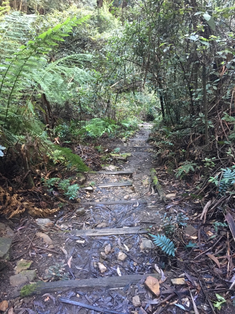
I have to say that it was brilliant - not at all what I would have done if left to my own devices, as I'm staying in a fairly hilly urban area, and so, without any races or goals ahead, I would have just gone out for slow plods (admittedly I still did a few of those.....and walked up some of the steeper roads and multiple sets of steps that there are). The challenges were definitely out of my comfort zone, but I didn't want to let the side down and so I managed to all of them. We would be on tenterhooks on a Sunday night (though sometimes it was a Monday morning before I found out as WA is a few hours behind NSW in timezones) to find out what she was "challenging" us to do that week. 
The "flat" run!!

Eurgh...trying to do
a kilometre progression run!
Some of the hardest ones for me were the short, fast efforts such as a 1K and a 2K time trial, a flat run (gaining no more than 30m elevation during the run whilst I would get that just running up the street outside), a shape run (Strava art is definitely a new one on me) and anything involving distances/progressions in kilometres (as I still run in miles and the only pace I know is in minutes/mile). 
The Sydney Harbour Bridge


The "elevation" run
Some of the "easiest" for me to complete were runs showing bridges (the Sydney Harbour Bridge is less than a mile from the front door), runs showing water (I managed to post pics of the sea, the harbour, a creek, a sewage outflow, a tap etc etc), elevation runs (how much elevation you can gain in a maximum distance of 10K...and I got to just under 700m going up and down a street I hate - and always walk up when it's near the end of run).

A city dawn...
Some of the most "fun" were the postcode run (Australian postcodes are 4 digits and you had to show them in some combination in the download of your run), the dawn run (Australia does some beautiful sunrises and sunsets....even in cities) and the 10KM -ve split run (getting the maximum differential between the first and second 5Ks with no walking allowed.....so trying really hard to jog as slowly as possible for the first half, and then going as fast as you could for the second half......tough but kinda fun.....OK so not during the fast 5K, but afterwards when doing the maths). 

A beach dawn just to
balance it out!
WA opened up (well within the state as their borders are still closed and locked down) before NSW so I was quite jealous to see that the others could do some of their challenges together, but I managed to push on and complete all of the 10 weeks that Tina set us. The Perth guys all met for a final run at the end of the challenge, whilst "we interstaters" had a session to do so we could be with them virtually. Darren (up in Queensland) did it first which motivated me to find a flat place to do it myself, though quietly I was dreading it as it sounded too hard for me. 

Knowing that I would have to report in was the kick up the backside I needed, and so I headed over to Centennial Park to avoid any big hills and road crossings, and then treated myself to a gooey chocolate brownie (whilst watching the surfers braving the large swell on Bronte Beach) whilst mentally thanking Tina for all that she'd done for us all during this difficult time, and knowing that I'd also made some new friends that I can't wait to actually see in real life just as soon as we're able to travel! All in all, it shows what an amazing thing the running community it....not just for physical health but for emotional and mental support too.....go Team Tina!!!

Wednesday 24 June 2020

The Great North Walk/Run

Another weekend meant another long run......I would have been happy to skip it, but when your sometime running buddy is training for an epic rough 100K trail race, then it would seem churlish not to go along and join in.


 This week's plan was an out and back route along the Great North Walk (which runs, in its entirety, between Sydney and Newcastle). I have walked sections of it (but not the section we were going to "run") and "gnarly" can definitely be rather an understatement at times, especially if you're not blessed with excessively long strong legs for clambering up and down large steps/rocks!

Things to come...not bad...
Having left Sydney at silly o'clock again, we parked at Girrakool, donned headtorches and set off on the trail down towards Patonga (I do know the beach at Patonga....and the sign saying that it was about 24km away didn't make it sound too horrendous). The first hundred metres or so were down a nice runnable trail, but that's about where the "easy" part ended. We had a very steep descent down to a creek complete with pools and waterfalls (though I couldn't see them in the dark) and I was warned about the fact that as we were going out and back, we'd have to climb all the way back up again later.....eek! 

Loving the dawn light...
Every so often we'd stop the crazy rough descent and I'd think we'd reached runnable trail, but then just as you started to move at a decent pace, something would break your stride such as rocks or trees so there was no way of getting into a rhythm. There were stepping stones to cross the creek but it didn't exactly flatten out there, as we then had to climb up and down on the singletrack at the far side. I didn't think we were moving that slowly but it took us almost an hour to cover the first 5K (but on a positive note, it meant that I had time to digest the bananas etc that I was munching on!).
Runnable rock platforms

I was starting to wonder exactly how long the whole "run" would take, not just because of the time spent so far and the roughness of the terrain, but I was also finding it rather hard work, as I'm definitely more of an easy runner and so my quads weren't exactly over the moon at the work they were putting in and I was feeling rather tired already. Thankfully we had a few nice runnable sections of firetrail interspersed with more rough narrow singletrack, and I did really like running across some of the open rock platforms looking for the GNW fingerposts which which reflect back the beam of our headtorches.
Typical "trail"!!

Unfortunately we missed an important turning so added on another mile or so before realising we'd descended way too far on a fire trail, and so (thank heavens for google maps) about turned and marched back up to the correct route. By this time it was getting light and so there were lovely views of Woy Woy tip (!) as we wound down past it, but to be fair the trails afterwards were rather pretty in the morning light. 

Not bad views in the
early morning light
After crossing the main Patonga road (well the only road in and out of Patonga in fact) we had another flat section of firetrail befroe climbing up and down steps to Warrah Trig. From here on and down the steep singletrack to the sea, we actually started to see other people getting out and about for their weekend activities. Unfortunately there were no amazing views (it's whale migration season so i secretly hoped to spot some from Warrah Lookout) as the early morning mist we'd driven up through had not lifted from the coast so it was a rather eerie atmosphere. My body and mind were definitely not in tune with what I was making them do, as I really felt that I should be stopping once I got to Patonga (maybe that's because I've heard a lot about races on the GNW that start and finish there) rather than turning round and going back the way we'd come.

However, after a brief break in which I had a drink and ate several of my homemade choc chip cookies I found I had a bit more energy once we'd started climbing back up - it's funny, no matter how many times I go running, I always forget that I need to eat before most other people as otherwise I just feel as if I'm tired and need to stop, whereas all I need is to put more calories in the tank! 
Some of the big steps/rocks
to clamber up!

Loving the rock platforms
I hardly recognised the route back as it was now daylight and so I could see both the trails and some of the beautiful views (especially when running back cross all those rock platforms). I made sure that I ate and drank regularly on this return leg, and the distance did seem to pass more quickly (though I was no better at climbing up and down the massive steps/rocks!). Thinking back to how we'd started, I was almost dreading the final 5km but it was actually only really the last 2K back up from the creek that were horrendous (taking about half an hour!) though I did try to smile and be chatty as we passed families out walking in both directions. 

The final out and back route
There was an option of refueling at the car and then going for another 15K out and back in the opposite direction, and although I could probably have managed to carry on for a bit, I decided that discretion was the better part of valour....50+Kms was definitely enough for me (as it had taken about 8 hours) so if I attempted another 30, I would just regret it as it would not be enjoyable and I'd probably end up injured and grumpy, so I told my friend that unfortunately from there on in, he was on his own! I was very happy to sit by the car, eat and drink, and then go down to my rellies for a shower, chill and wine o'clock...pleasantly tired but with a lot more climbing in my poor wee longsuffering legs!

Tuesday 16 June 2020

Finally....the 6 Foot Track (only plus a tiny nav error.....whoops!)

Profile of the 6 Foot Track
I finally made it to the start!!
Having come over to run the "6 Foot Track" back in early March, it seemed slightly weird not to have even seen anything of the actual route, so when my friend Julian said that he was keen to go up to the Blue Mountains for a day and do some bushwalking, I jumped at the chance to go with him and check it out. He had said that he would kindly drop me at the Explorer's Tree (the start of the track), then go on his hike and drive round to Jenolan (the end of the track) to pick me up afterwards. It was a very kind offer, as the road to Jenolan had only just reopened and if I wanted to travel the route myself, it was going to involve very complicated logistics (Katoomba is about 2 hours by {a very slow} train from the centre of Sydney, and then it's a few kms to get from the station to the Tree.....and I wasn't convinced how accurate information about buses back from Jenolan was.....and to be fair we didn't see a single bus on the roads all day) and so I was eager to take him up on it.

Obligatory photo shoot :-) 
The drive from Sydney took about 90 minutes (a good chance to fuel up on coffee, banana bread and croissants) and so I was dropped off about 9:30am. The 6 Foot Track covers about 45km to reach Jenolan Caves so we figured it might take me about 5 or so hours, and as we doubted there would be phone reception there, we arranged to rendez-vous at Jenolan House as the café there had recently reopened.

After the obligatory start photo I headed off down the "track". Initially it was a fairly wide gravel trail....it descended relatively steeply but seemed just about runnable to me (though I wouldn't have been that excited to be going down it in a race situation when people would have been pushing and shoving and sprinting off the start). 

Wood-edged steps
I soon came across a clearing after which the trail narrowed and steepened to descend down Nellie's Glen. I could see why this part was marked unsuitable for bikes as there was about 300m of very rough, narrow steps through dense vegetation, under rock walls and officially "crossing a small creek many times". In fact it was rather dark, cold and wet with the creek running down the rock "steps" in many places. Some of the steps were edged by pieces of wood, but the soil had been partly washed away so the word stuck up to trip unwary travellers not lifting their feet properly.

Is it a creek or a trail?
This was really out of my comfort zone (note....if I ever do run the "race", I must start at the back of my starting pack or I'll delay everyone else and come a cropper myself) and I couldn't exactly run it. I used the excuse of taking pictures to make many stops and realised that it was going to be a very long day if I had to walk the downhills as well as the uphills I knew would come later (the route officially had 1500m of ascent and 1800m of descent). I wondered what I had let myself in for and briefly debated how to pull the plug on the whole adventure. Still, I figured it would help develop my "mental toughness" so I carried on, albeit rather tentatively. 

Happily flattening out
Luckily the trail flattened out considerably and became much better underfoot so I could relax, and start running along it to enjoy the scenery of the scribbly gum forest. I came out onto a dirt forestry road, waving a friendly greeting to a couple of hikers coming along in the opposite direction. I could turn my legs over nicely as the forestry roads were wide, clear and relatively straight so there was a lot of time to work out how to avoid the worst of the mud and puddles whenever I spied a tricky patch coming up, but the running itself still didn't feel too good. At least my hands etc had warmed up by now, so I gave myself a little talking to, as it didn't matter how slowly I "ran" or walked....the aim was just to have an enjoyable day out somewhere new. 

Prior route markings
The trail had been quite well marked up to this point, so I wasn't paying that much attention to my route....which I came to regret slightly further on, when I ended up on a sealed road, passing houses until I came to an unmarked t-junction. I was debating digging out my map when I spotted a sign that said the 6 Foot Track was 700m to the left.....oops! As it turned out, as the trail and all access to it had been closed for so long, some of the signs had been obscured by overgrowth whilst a few others had rotted and fallen down (though I still should have been paying much more attention). I kept the map out for the next kilometre until I finally rejoined the track where it crossed over the road I was now on (the sign saying 700m rather underestimated the distance which also caused me some minor confusion). Luckily that was my only nav error of the day (if I'm honest that's probably because I was walking a lot more later and so checked the map more frequently if I hadn't seen a sign for a while 😂).

Views=an excuse for a photo break
After rejoining the route, there was a short section through wooded land before I came to more open farmland. Sometimes the trail was on wider dirt roads and sometimes on narrow single track. At one point I had to descend steeply, cross a small wooden bridge and then climb up some steep wooden steps the other side. The views were great (which basically was another excuse for a photo break as I was really hot by this time.....not a cloud in the sky and not a breath of wind) and it was so different to the start of the trail. 

I met the only other person I saw all day on this section - a French walker going in the opposite direction - and so it really did feel like I had the whole of the countryside to myself. As I wound along the side of the valley I vaguely contemplated what to do when I spotted a sign for "alternative route when river flooded" but at this point I was feeling so hot and bothered that I didn't really think about it much, having also conveniently forgotten that people had told me about deep streams you have to wade through in the race. 

The Cox's River - deeper than it looks!!
When you cross the floodplain of the Cox's River to the river itself the path peters out and it becomes a case of just picking the best route you can. The river appeared to be a lot wider than I'd thought as it was divided up into quite a few sections. I managed to rock hop the first couple but there was no way to cross the main bit without getting wet. It's a good thing I was wearing shorts rather than capris as the water was thigh deep in one spot. To add insult to injury, the section from the river up to the campsite the other side was soft sand.....always a delight when you have sodden shoes! 

From Cox's River campground, the route certainly tests your mental strength as it felt like 5k of constant uphill grafting. There were a couple of small creeks to ford, but as my feet were already soaking wet, there wasn't much point in trying to get around them. There were signs warning any 4WDs of walkers in the road for the next 20k (which reassured me....after another mapcheck....that I was going the right way) but I only saw one vehicle the entire time.

Rather than completely lose the will to live dragging myself up those steep slopes, I decided to "make the most of it" and use it as a chance to get some more calories in....as there's no point carrying food in your backpack when you could be carrying it in your stomach now is there? An extra benefit of all my baking is that I'm not short of cookies or banana bread to eat.....yummmm!!

"Topping out"
I topped out, descended to another basic campground and got excited at some flat running along a valley floor, past some deciduous trees (a rarity in these parts) but the excitement was rather short lived as it soon kicked up again and I was reduced to another slow plod! Still, at least I knew (or I should say that I "thought") that this was the last big climb up to the highest point of the day and from there it would be mainly flat along a ridge and then down into Jenolan (or so the profile on the map led me to believe).

I was surprised to see the odd deciduous treee
Many kilometres (I would say many hours but I guess it wasn't really quite that long....though I was rather worried at how long Julian would have been waiting for me at the far end) later I reached the top of the ridge and from there it was actually really nice to run along the undulating fire trail through dappled woodland. I didn't have much of a clue of the time of day, as I'd had so many stops en route for photos, food, wades, mapchecks, "comfort breaks" etc, but the heat had definitely faded somewhat. It could have been that I was just a lot higher now, or that it was very shaded, or that I was much more tired.....but whatever the reason, I was glad of it (except for when I realised that my hands were starting to get rather cold again....I tell you, I'm never happy am I?). 

The distance ticked by as I made myself keep jogging along (the undulations were actually quite small so keeping the pace low meant no walking was needed) and the few intersections were well marked so I soon came out at the last campground on the Track....and just after that I passed the sign marking 10k to go.....yeay....the countdown was on!

Exciting - another National Park!
The last section still contained some cheeky bits designed to play mind tricks on you. I'd hoped that it was mainly downhill now from the ridge to the caves and the trail was quite nice and soft through woodland, but I was wrong.....every time I rounded a corner, I'd find another steep slope to climb! About 3k further along I crossed the sealed road to Jenolan (along with a sign welcoming me so I figured that I was almost there after all). 

Having crossed the road, the trail seemed to track alongside it for a couple of kms, winding up and down slightly through the trees (with some steps up and down) but mainly beside it.....now if I'd realised this, would I have just run along the empty road to get there sooner, or would that have been cheating myself out of covering the "proper" route?

I officially only had about 5k still to go when I got to the "Jenolan Caves Cottages" and the road sign proclaimed "windy next 11km" so I decided the track was by far the better/quicker/shorter option as the two routes diverged considerably at this point. The trail undulated for another couple of kms along the ridge before narrowing into since track and diving steeply off down the side of the valley. I would get glimpses of building below me through the trees as I descended (though they were just glimpses as I couldn't afford to be slack about foot placement and so needed to look where I was going). A rocky saddle and some descending timber steps put me out in a gravel clearing with a sign pointing back the way I'd come stating it was the "6 Foot Track". 

The end of the track....and relax!
Caves House...and more importantly...the cafe!!
This seemed to be rather an anticlimax for the end of the track as there was nothing there, so I looked around wondering what to do. I'm not sure why I hadn't spotted the "Caves House" sign straight away, but once I did I followed the arrow up a stone path (with a handrail no less....though luckily I didn't need it), past an amazing rock arch and then I zigzagged steeply down it to some concrete steps which led to Jenolan Caves House and the official end of the track.
Done!!!

Julian had been in the café a wee while waiting for me, but it meant that he'd had a chance to grab some food and catch up on emails, and could greet me with a very welcome coffee, ice cream, sandwiches and cake. We swopped pictures of our days, and then headed back to the city, tired but happy after a good day out in the Mountains (even taking in a viewpoint or two on the drive back).

Monday 8 June 2020

Brisbane Water Bush Bash

The Brisbane Water Bush Bash
A few weeks ago, my friend Simone (a member of the Terrigal Trotters, which is a running group based on the Central Coast) showed me an interesting route called the Brisbane Water Bush Bash. This is basically a 50(ish) km run which circumnavigates Brisbane Water, the "sea inlet" on which Gosford is situated. We'd planned on doing a long run, and as it was the last day on which my "tourist visa" was valid, it seemed fitting to mark the day by doing that route (though I later realised that we actually went the opposite way round the loop than the traditional route, which used to be a "race").

Some parts of the trail
were rather rough
We left Sydney at silly o'clock (though that meant no traffic and so the drive up was much quicker than normal) and started running well before sunrise. It was quite chilly so I started wearing a jacket and gloves as well as my head torch, but the jacket and gloves were soon discarded as we got going. Unfortunately we had to run over 1km along a firetrail to join the actual route, which wasn't much of a problem at the time as the gentle downhill was a nice way of easing into the run, but it did mean that we would have to run back up it at the end!!

At first, no checking of the route was necessary as I knew the rough trail and steps down onto the roads of the Coast and from there we joined the cycle path from Point Clare round into Gosford, which I have run and cycled many a time (just never at that time in the morning!!). Minimal traffic meant the road crossings in Gosford itself were simple and we were soon heading up away from the water into Rumbalara Reserve, which is a hilly forested reserve right in the middle of town.
Dawn was beautiful!

Dawn might have been breaking but we couldn't discard out head torches as the thick canopy added to the layer of darkness. The single track in the reserve seemed shorter than I remembered from looking at the route the night before, and indeed, I suddenly realised that we'd missed a vital turning as, just after we exited the trees, I spotted that we were actually heading right back to the Gosford Waterfront where we'd left it (it just looked slightly different when going in the opposite direction with different lighting).

There were some great views
An about turn meant going back into Rumbalara and finding the right route this time....the distance and climb of which seemed much more appropriate to what I'd seen. As it was now getting light, a couple of walkers and runners were venturing out.....and comically enough, one even asked for directions!! We climbed up and down on various trails overlooking different suburbs until popping out onto a sealed road heading down towards the main road out to (and up the) coast. There were some huge houses along this road, with great open views....made better by the odd spot of a kangaroo (or was it a wallaby?).

Not your average "road"
Most people were still in their beds, so crossing the main road was easy enough and we could run the next little road section without fear on being mown down. Although you'd think that most of the run was on roads, as they all seemed to be named when you looked at a map, most "roads" were rough forestry ones so it was actually a lot softer underfoot than expected. The sealed section wasn't that long, as you soon hit the trails around Kincumber Mountain. In all the years I've been going to and from the Coast, I've always meant (but failed) to venture over there.....it's not exactly what you would call a mountain, but does has some nice paths/trails on it for running, walking and mountainbiking. A bit of scrambling over rocks and branches was involved (shhhh) as the trail had been taped off by a local not wanting people on the land behind their house, but this section was short if slowgoing. 

Spot the pink tape...
Soon after that, the official route was totally barred with high locked gates, but there was a tiny little trail that led through the woods instead. Thank heavens for the pink tape that had been put out to mark this new trail as it certainly meandered around a lot, and involved a few creek crossing as well as several tree/branch negotiations!

More trails...
After several more kms of tarmac (I was definitely feeling rather less than fresh by this point, though having something to eat on stopping at some public watertaps/bathrooms helped!), it was back onto forestry trails. There was a barrier across the start of this trail section, and several fire and rescue and ambulance personnel seemed to be having difficulty in unlocking it. They made no comment as to why and so it seemed ok to run around the edge of it and carry on, though a bit further along the trail it was obvious what they had been doing there. A mountain biker had obviously come a cropper, but luckily I did not need to try and help, as he had already been splinted and put on a stretcher by some paramedics who'd managed to walk in, and they were just waiting for their pickup/extraction.

Some trails were much
more runnable
I knew that the route went from almost sea level to the top of the escarpment of the Bouddi National Park and so I was slightly dreading an epic climb, but after yet another steep walk uphill on this trail, I realised it was done and the undulating trail that almost tracked the ridge top road was eminently runnable (though there was a guy that seemed to be doing intervals along it....he disappeared away into the distance, then you'd almost catch him, before he'd take off again!!).
On the way down to the water

In my head, all that was left to do was to drop down to the Rip Bridge, run round the Woy Woy foreshore along the park run course, and then climb up the impossibly steep hill behind my rellies' house back to the firetraps where we'd started.  In reality, the "drop down" to the bridge consisted of some significant uphills as well (walking rather than running all of them by now....and not a fast walk at that!), and the parkrun course was not quite the flat run it appears when you're only having to go 5K :-) 

The picture makes the horrendous
climb look rather flat!!
However, the cycle path around the next section of foreshore was nicely paved so I didn't have to worry much about picking up tired feet, though somehow I almost managed a stumble anyway. The sun was out and it was getting rather warm, but there were a few drinking fountains, and I felt like I was on the home stretch anyway, so I knew I'd make it!

More creek crossings
Over and under the Spike Milligan Bridge and I was on familiar territory (from dog walks and one trail run) but I was very aware that this section would take longer than you might think and the initial climb was so steep it could make you weep. Whenever I've taken the dog out there, I've had to haul myself up by grabbing hold of trees etc (and use them to stop me falling down it on the return trip).....and that was when I hadn't run an epic number of kms first. There's a brief flatter respite partway up, but then it kicks right back up again. 

On reaching the watertower at the top of the climb, it was finally possible to run again.....but not the whole way, as the trail crossed a creek and then appeared to climb up almost vertically on the other side. It was quite sludgy underfoot as the trail was undergoing "roadworks" and so was a real mess of holes and barriers. By this point in the run, there seemed to be a never-ending number of hills, but on a normal day, it wouldn't have been an issue to keep moving along at a decent pace.

A different view of Brisbane Water
Sunset over Brisbane Water -
best enjoyed with wine :-)
Finally we got back to the junction where we'd joined the loop all that time ago, and it was a relief to be heading back to the car. Some walkers were on this bit of trail and so although it gradually climbed uphill, pride meant that you couldn't just walk it. A refuel and change at the car and I was kindly dropped down at Koolewong for a very welcome shower, more food and a catch up with Anne and Andrew. I had really enjoyed the run, as most of it was new to me....but I have to say that it was much easier to sit on the deck and drink a glass (or two...or three) of wine watching the sunset over Brisbane Water than run round it!!!