Tuesday 31 August 2021

The Deuchary Hill Canter

 I have a couple of good friends that regularly kept in touch and checked up on me whilst I've been in Australia, so I could not visit Scotland without going to see them. I started off with a trip to see my "running mum" Fiona in Falkirk......and not only did she treat and pamper me....but she also dragged me along to her running club session that evening. 

Our morning "recovery run"

It's a long time since I've done any group run, and especially efforts but it was fun (well, it was fun afterwards if not at the time!!) and then we rewarded ourselves with a nice recovery run out along the trails for a coffee the next morning - though we had so much to catch up on, it was hard to stop blethering!!

More coffee....and more blethering....

From Falkirk I headed up to visit Sam, who lives out in the countryside near Perth. She and her partner have moved since I last saw them, but their new place was amazing as they've done so much to it (and even got a new cat who welcomed me by bringing me all his toys as gifts). There's never a dull moment when I stay with Sam and Mark, with lovely food, plenty of alcohol and banter a plenty. Unfortunately this means that we talk each other silly things, eg Sam agreed to run parkrun with me as long as I agreed to do a hill race with her (any plan agreed upon after lots of wine has to be sound doesn't it?).
My new bestie.... 

As previously mentioned, we did a lovely parkrun around Loch Ore in the Saturday, so that meant I had to do the "Deuchary Hill Canter" on Sunday morning - eek!! It was only as we drove up to Dunkeld to register (and the hills sprung up around us) that I realised exactly what I'd let myself in for.....it was an 18K run with 800m of elevation gain!!! Not only that, but I wouldn't be running with Sam as she'd elected to go off the "early start" which was half an hour before the main field set off :-( 

The Deuchary Hill Canter

Registration and kit check done, we then had to drive through town and out the other side to the sawmill carpark that was the closest place to the race start/finish. A gentle meander through forest took us to a muddy lakeside trail in plenty of time to wave Sam off on her run. The race starts with a rather steep climb after just a couple of hundred metres, but I guess that thinned us all out as we could only really go single file due to the narrowness of the path. I was certainly feeling both the session with Fi and the parkrun in my legs and so was more than happy to let everyone zoom away past me. Once we'd finished climbing, the path contoured round the hill below some small cliffs and I found it very unsteady going as there were lots of wet roots underfoot and the path was on a rather dodgy camber, making me worry about tumbling off down the side of the hill again. I was glad to have no-one in sight of me up ahead as then I didn't feel any urge to push faster than I was capable of....or no doubt I'd have come a cropper!!
Pre-race in the sawmill carpark

I was actually surprised to see a couple of people some way ahead of me when the forest opened out onto a forestry road that wound a good long way downhill, and it gave me the motivation to get my legs moving, especially as the first one I passed was a lady :-) Unfortunately the next man that I passed told me that I'd not even started the climb up Deuchary Hill yet, but at least he warned me that it was an unrunnable climb, even for the top guys, so I didn't feel so bad about having to use my hands to haul myself up. The climb was certainly way more than the first hill we'd ascended so I realised that had just been a little warmup....but it was nice to get to the summit as there were fantastic views in all directions.
The climb up Deuchary Hill?

The "fun" wasn't over yet, as the route wasn't just a simple out and back to the top of Deuchary Hill - instead we carried on over the top and down the other side. Some of it was lovely runnable descent, but some of it was a bit hairy for me, so I was overtaken again by those I'd just passed (all that work for nothing!!!) - pah!! Och well, I managed to get them back again as soon as we had some more climbing to do (as this was a runnable climb)....and it was on this section that I passed Sam so we gave each other a good cheer of encouragement.

I remembered the map showing a short section where we retraced our steps from the outward leg before we should turn off to the left to complete a (vague) figure of 8 shape. After a short way, I spotted some walkers coming down a track to my left, so thought that must be the way to go, especially as there were no marshals to ask, nor route markings to follow. After about half a mile, I did stop and check my map as it just didn't feel right to be near water - and as it turns out, I had turned off way too soon so I had to retrace my steps again (picking up a couple of other runners who'd just seen me heading that way and followed - including the very same lady I'd been playing cat and mouse with all run).

Back on course I climbed up for what I hoped was the last time - first on a forestry road and then on rough tussocky open ground, and then trotted off down the far side, convinced I was going to be passed any minute. At the pre-race briefing. they'd described a "fast and furious" descent down to a carpark, which implied a short distance to me so as soon as I was off the rough ground, I went as fast as my legs could take me. Unfortunately for my burning quads and chest, it was actually about 3km of descent, allbeit broken up slight by me trying to find a way across and out of the other side of the carpark (why do cars park so cunningly as to hide the path?), but I was delighted to see that I was the first lady back as I wobbled across the finish line.....and then to realise that I'd put about 30s per km into those following me down that last descent. It gave me a chance to get my breath back, have a drink and accept my "prize" (1st, 2nd and 3rd all got the same) of a buff depicting the beautiful lake where we'd started and finished, before cheering and whooping Sam across the line!
With my prize (and compulsory kit)

Looking back on it, I am so glad we made the trip up there and ran the race, as it was new countryside for me....and another lovely day out :-)

Tuesday 24 August 2021

The Southern Upland Way Part II

Beattock...that's over halfway...right?

It was so nice to get into the Beattock CP and see both the smiling faces of the volunteers there....and spot my dropbag containing clean, dry shoes and socks....and it was a surprise to see Nat there, but she left just after I entered. Covid rules in Scotland were such that you had to wear a mask to enter a building but then you were allowed to remove it to eat and drink, so it felt a bit like doing the hokey-cokey sometimes having it on-off-on-off!! 

Getting to Beattock, I convinced myself that every step was a step closer

The first thing I did was peel off my wet shoes and socks with a huge sigh of relief.......and the volunteers exclaimed over the start of my feet....trenchfoot eat your heart out! The skin was macerated and white and just generally disgusting! I sat on the edge of the stage to air them whilst being waited on hand and foot - well, I was brought 2 large plates of food (1 of boiled salted potatoes and 1 of delicious hot pasta and veggie sauce) and and a mug of coffee and long with some cordial. I had also developed some ankle pain during the past couple of sections which was making trying to run quite difficult - it was probably due to a combination of constantly rolling my ankles slightly on the uneven ground (especially in the night/in the boggy areas) and a recurring issue of tibialis posterior tendonitis (interestingly, although I'd been struggling with some achilles pain for many weeks, I hadn't felt it at all during the event so far). Having had a good feed and sit down, I took some antinflammatories from my dropbag and hoped they would kick in. 

I could have kissed the volunteers when they offered to give my feet some TLC....they even had talc and tape so I did not need to delve around in my supplies too much...and soon I had dry feet, my ankle taped, clean socks on and was debating how long I could leave it before putting on my "new" shoes! Time enough for another mug of coffee anyway, and then it was on with the shoes, and off with me as I had been there for a good hour! As I headed back out of Beattock the way I'd come in, I realised that I was no longer in pain and could actually run again (maybe not at any earth-shattering speed, but I was definitely running) - yeay!!! 
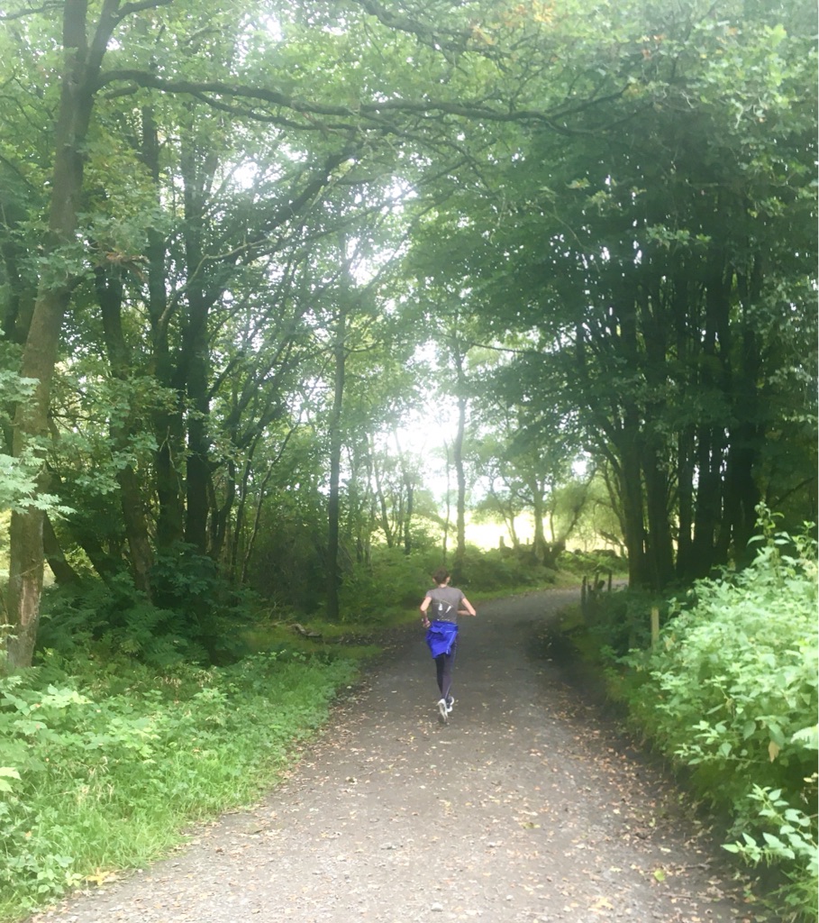
So good to be able to run in the hills again!

Having also worked in that area, the roads and hills around Beattock and Moffat were slightly familiar to me as well, and I was just so happy to be running again that I couldn't take the smile off my face! It was also nice to see the odd friendly face out on a hillside enjoying the day and cheering us on. As I climbed up out of the undulating Moffat farmland and back into forestry areas, there was a big route decision to make. To be fair, there wasn't really a decision to be made, as the race instructions distinctly told us that we must take the "high route" and climb Croft Head rather than stay on the forestry road that continued up the valley. I caught up to another runner just before the two routes diverged and he was having none of my "we definitely have to go this way" and insisted on taking the "low route". I stuck to my guns and actually really enjoyed the really steep climb up in the sunshine as, on reaching the summit, it was a glorious ridge run through the heather with fantastic views all around. I could have shouted for joy....which is rather unusual for me on a ridgeline....but I have to admit that it was my favourite part of the whole route, and (even more surprisingly) I also loved the steep winding path down the Cat's Shoulder at the end of the ridge. 
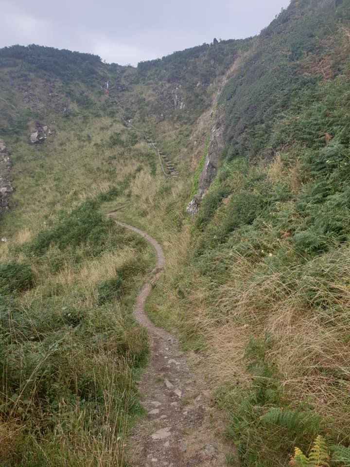

The Cat's Shoulder

What did surprise me on the descent (though I guess it was not altogether unexpected) was to see that I would have to pass the same guy again, as the low route was much shorter and less strenuous, hence he was ahead of me on the trail again. However, as I climbed up the path to Ettrick Head, I passed the race organiser who stopped me for a photo and video chat/interview, and he advised me that anyone who had taken the low route (and he did mention the very same runner by name) would be given a time penalty. To be fair, the time penalty didn't really bother me, as my main sadness for anyone not taking the high route was that they would miss out on the best bit of the SUW! 


Admiring the view having not just survived, but loved, the ridge!!


Reaching the watershed


Ettrick Head is not only the border between Dumfries and Galloway and the Scottish Borders, but it is also the watershed of Scotland so now I was going the same way as every drop of water en route (even if I feared some might be going there in my socks/shoes later on!). From that highpoint there was a really long runnable stretch, initially down through forestry, but then along a quiet tarmac road, and so I just let my legs go, enjoying being able to turn them over at a fairly decent speed (I think I actually did some 8 minute miling!!). To reinforce my belief that I was having a good stretch, I caught up and passed Nat on the road, and bearing in mind she'd left Beattock a good hour before I had, it reinforced the benefit to me of time spent refueling and looking after myself properly at CPs. 

Woohoo....a runnable stretch....

Unfortunately this CP was another one which involved going over a mile beyond where the SUW turned off the road, and the CP flags were on the wrong side of the road by the wrong building, but I eventually found the right place (and gently suggested to the marshals that as we were all carrying trackers, it might be a kind gesture for them to be looking out for us - which they obviously took on board as they went out to wave Nat in on her arrival). When asked what I would like to have, I requested 2 large portions of whatever food they were serving, a couple of mugs of coffee in succession and then also restocked my pack with snacks. I was given a plate with 2 massive doorstops of toast covered in a whole tin of baked beans to work through....and just as I finished it, another one was brought out for me. I think it was harder to get all that food down that any part of the run so far, but I'd asked for it, so I felt I had to consume it.....though I never wanted to see another baked bean again by the time I finished! 


The endless baked beans....

I had been going to ask Nat if she wanted to buddy up for the rest of the distance, and if not, then at least overnight - as I'd enjoyed the company and the chat over the previous night and it had made the hours of darkness pass by more quickly. Unfortunately I didn't get a chance to do so, as she came into the CP, said she wasn't stopping but just grabbed some food and drink to take with her and was back out of the door within minutes. Once I'd finally finished my beans, I got my night time gear ready, stocked up on snacks and headed on my way. I caught up with Nat again after retracing our steps back to the SUW and we left the road together to go up and over to St Mary's Loch. She was using poles so could power away ahead of me in the steeper hiking sections, but whenever we ran I would catch her back up. As it flattened out, there was a bit more running than walking so I stopped and waited a few times in order for us to stay together as the evening drew in, but this sentiment was not reciprocated so I eventually decided that the next time I caught her up, I would just keep on going. 

Down by St Mary's Loch

I did briefly stop at the bottom of the hill, as the way through the campsite between St Mary's Loch and the Loch of the Lowes wasn't the easiest to spot and I wanted to make sure Nat could see where to go, but then I carried on running along the beautiful trail that undulated along the water's edge. St Mary's Loch is 5km long, but I managed to keep my pace up so that I made it all the way to the far end before needing to put my head torch on, but unfortunately the light gave out as I crossed the road at the far end towards the ruins of Dryhope Tower. 

Imagine this...in the dark...with hidden barbed wire

I'm sure that the next section would make a lovely scenic daytime walk up and over Blake Muir and down to Traquair but it was not exactly my best section of the route. I started off stumbling over every single tussock and falling into every single hole across some rough ground in the dark.....and every time I'd think I was on a little trod going in the right direction, I'd then lose it again. At one point it felt like I'd been thrashing my way through bracken for about an hour, only to find myself back at the SUW marker post I'd previously been at - grrrrr!!! I did come to total standstill at one point when I managed to embed a prong of barbed wire all the way into the back of my thigh, and had to physically pull it right out to be able to move again - nice - only to then feel the back of my leg getting wetter and wetter with blood (o the glamourous sport of running!!). Eventually I got myself going in the right direction and found my legs again on the long steady descent towards and through Traquair (I've been to Traquair House in the past, but I somehow didn't think the cafe and microbrewery would be open in the middle of the night!!). 

And mist....

As I headed out the other side onto the rough trails that climbed up onto Minch Moor I got the shock of my life when a man appeared out of a hedge (OK so he had been sitting in a car and there was a gap in the hedge there, but I was rather tired!) and offered me food and drink. Although a very kind offer, I still had a fair supply in my pack, as I was feeling rather nauseated due to lack of sleep, but as my head torch had been acting up slightly (I think it was actually the fact that it tends to dim when it encounters anything reflective rather than a battery issue) so he kindly lent me another one (there's nothing like running with three headtorches on you!!). 
Not exactly the easiest to fight your way through....and it's even worse in the dark!!

The map then showed several miles of wild open moor to cross, which sounds relatively straightforward, but I did manage a few "loop the loops" of rough bracken and heather, stumbling up and down slopes trying to find my way safely. I had to pass the "Three Brethren" which are cairns marking the meeting point of three of the largest Scottish estates, and although  they looked quite ominous as they loomed at me out of the dark, it was actually a huge relief to see them and know I was on course for the next CP. As I then entered woodland I passed a man who looked like he was struggling a bit with back issues - and it turned out that he was the long time race leader. Further on down the trail, I met his support crew coming out to find him on mountain bikes - but I was amused when they asked me the way, as I was doubting my navigation at that point thinking that I really must have missed the CP somehow. 

The Three Brethren in daylight

Luckily I hadn't, and it was just further than it appeared on the map - and completely unlit in the dark - but I finally made it......and found that the male leader of the race was there too. He saw me and hastily put on his pack and set off again, whereas I had to stand for a minute or two to let a few waves of nausea settle. The back of my leg was covered in blood, but I guess we are meant to look after ourselves during the race so when I asked for some help to clean it up, I was offered a few wet wipes. Luckily they actually did the job and the flow had almost stopped. I couldn't really face eating anything (I know - unheard of for me - so I just had a mug of hot chocolate and decided to try to get a bit of sleep to make me feel more human). There were no mattresses there but there was a small sofa so I sat down on it and put my waterproof across my face to block out some of the light. I longed for ear plugs as sleep did not come, but after about half an hour of sitting there "resting" I felt like I could stomach some food. 

A bacon butty and mug of chocolate later I tried for another kip....but after another fruitless half hour of trying, I decided that I might as well get on my way and hope to get some sleep at the next CP. By this time it was starting to get light again, but I still made a few wrong turns whilst finding the route out of there. I found it hard to get my stiff legs to run again, and so "luckily" I was soon climbing another hill, hence walking was the perfect pace to go. Up and over I went and down into Galashiels - and I think I'd timed it "perfectly". It was daylight so I could see where I was going, but still too early for people to be out and about on their way to work and catch sight of my sorry bedraggled self trudging along the streets (I did get one funny look from a cyclist!). 
Along the banks of the River Tweed

The route then followed the river to Melrose, which was really pretty once you got to the riverside, but it was rather dispiriting to cross a suspension bridge and realise you had to go a long way back the way you'd come, along the other side of the river before heading up into more farmland over Kedslie Hill and down into Lauder. All the way down into Lauder, I was encouraging myself with thoughts of some good food, a lovely cup of tea and a sleep, but when I arrived into town, I just could not find the CP. I trotted up and down the 2 main streets that seemed to run parallel to each other several times but just could not locate it and after about half an hour, I decided to give up, but something at a local shop and just carry on my way. 

On leaving Lauder I got to pass through the grounds of Thirlstane castle, which I'm sure is a beautiful place to visit, but I was just so devastated to have missed my long awaited lie down, that it was all I could do not to cry! I had to cross a road at the far side of the castle grounds, but suddenly heard my name being called. A van drew up, and out jumped one of the lovely marshals from the Lauder CP. She said that she'd spotted that I hadn't been able to find them from watching my tracker and so decided to find me. She gave me a big hug (which caused me to actually break down and cry), and told me sit/lie down in the back of her van whilst she gave me some food she'd brought from the CP and boiled me up a cup of tea on her van camping stove - what an angel!! 
So happy to see the marshal looking for me that I even played aeroplanes :-)

View to the Eildon hills
The 10 minute nap I had in the back of her van was amazing, and I managed it without even spilling my tea (Ok, so I actually just dozed off whilst sitting there holding my mug, but it was magic none the less).....then I had another big hug and was sent on my way again, climbing up onto the Lammermuirs. This heather moorland is relatively flat so the views stretched out away from me to the horizon. 

On the Lammermuirs

The only problem with such a panorama was that you could see just how far you still had to go, but then again, I could also see my next "target" from a long way off. As I headed for the high point of the Twin Law Cairns  (huge stone cairns built as monuments to two warrior brothers), I realised that I'd not seen another soul for hours and it was as if I had all of the moors (right across to the Eildon and Cheviot Hills) to enjoy by myself. 
Twin Law Cairns coming into view

The descent down to a minor road was lovely underfoot, and before long I was traipsing along round the side of Watch Water Reservoir. I thought I had to go beyond the end of the reservoir to get to the next CP, so it was with delight that I crested a small hill and saw it just ahead of me. It was soooooo nice to have a proper sit down and get some decent food into me (and the marshals even did exactly as I wished, and put large chunks of butter on my bread :-) )!! I was enjoying the chat (OK, yes, and the rest) so much it was with great reluctance that I left them to it and carried on my way through a tiny village called Longformacus (I think the name was longer than the village itself) and a few farms. 


Masked up to enter the CP by the reservoir
Eyes swollen from lack of sleep, but loving the bread and butter!

As I passed through endless farmland (occasionally going right across planted fields when I couldn't see way around - sorry Mr Farmer) and then woodlands, I kept looking at my watch and trying to calculate how far I still had to go. I really really (really) wanted to finish before sunset, but this was countered by the fact that I really really (really) wanted to lie down where I was and cry/sleep!! Tough call - and many a mental battle ensued! Even when I crossed the main road going into Cockburnspath, I still wondered if I would ever make it to the finish. 


A nasty (which sadist put that there?) twist in the route meant that I had to zigzag up a really steep wooded hill before approaching the coast. I have to say that this did seem to be a rather pointless addition to the journey (no, it wasn't just me taking a wrong turning) as there was actually a path around the base of the hill....and you never actually broke out of the trees so it wasn't as if you were sent up there for an amazing view or anything!! Earlier on, I would have loved the run down off it, but my legs were so stuffed by this point (doubly so after the tough trudge upwards) that it was too painful to manage much more than a "running hobble/limp" as I descended.
As it turned out, it wasn't exactly going to be a short run anyway!!
 

I came out of Penmanshiel Woods and hoped I'd finally be directed into Cockburnspath, but no, the route took me away from the village and down a small road towards Pease Bay and way too many metal steps that I had to descend, ascend and descend again. I decided that if I was going to be sent down onto the beach and back up again, I would stage a sit down rebellion until someone came to find out why my tracker wasn't moving!!! Luckily for my mental health, I didn't have to go down to the beach....but I'm not sure that having to go up onto the clifftop path was that much more pleasant. If I'm honest, I'm being more than a bit harsh in saying that, as the cliff top path was stunning - with several rocky, atmospheric coves and cliffs to admire in the waning sunlight. 
On the final clifftops

Just as I was wondering how many more clifftops I would have to run round, I spied a figure up ahead. It was Tubby, an old Dumfries Running Club mate who had been volunteering in the early stages of the race and then come over to help at the finish. He'd run out to encourage and see me in.....and got me moving a lot faster by telling me that I only had a mile to go and that i was going to break the FKT (fastest known time) for the SUW as well as the race CR (course record). I managed to up my pace and ran as hard as I could...but after about a mile, I asked him again where the finish was....only to be told that it was still a mile away....luckily for him, I had no energy left to swear (and he could have run away from me much faster than I could chase him!!).  
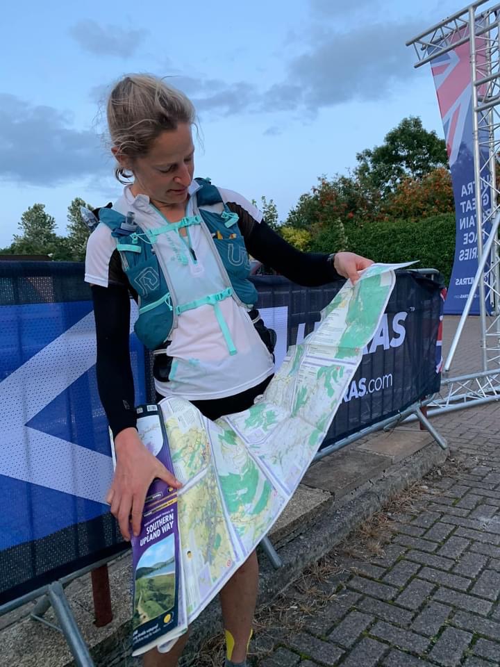
Dying on the final clifftops, map in hand

The final stretch into the finish

The race director also came out of the village (with a camera.....though I'm fairly sure I was not looking my most photogenic) to escort me in as I still had a couple of fields to skirt, a road to duck under and then a nice climb into the village itself. Pride wouldn't let me stop running and at last I rounded a corner, past the war memorial and saw the finish gantry. The sun hadn't yet set, my friend was waiting for me.....and I was told that I'd set a new FKT despite my added kms (I ended up covering 375kms instead of the official 345km of the SUW) and had broken the ladies' CR by 17.5 hours......so not a bad result despite all my misgivings and threats to myself to quit!! The icing on the cake was a hug from my mate and then being driven to my other friends' house for a good feed, a shower and a bed (though somehow I still couldn't sleep!!) - magic!!

Still no clue re my nav....even at the finish!!
My finisher's buckle and trophy!

Monday 23 August 2021

The Southern Upland Way - Part I


I hadn't been in the UK for more than a few days before I was feeling overwhelmed  and so thought that I should look for a nice long run to do so that I could (selfishly) have a bit of "me time". I came across the "Race Across Scotland" (an event put on by "GB Ultras") that started at Portpatrick (on the west coast of Scotland) and followed the Southern Upland Way right across the country to Cockburnspath (on the east coast).


OK, so it was rather a lot longer than I had planned on running (and an awful lot further than I had ever run before) at 345km, but in the early stages of the run, it seemed to pass by a few places where I had worked in Dumfries and Galloway, and so I figured that if I wanted to pull out, I would either be able to get myself to a train station to make my way home, or be able to ring a friend to ask them  to come and pick me up with my tail between my legs.  The race organisers preferred runners to have a "crew" this year (for fewer interactions at the CPs - ie keeping Covid-safe), but I did not want the pressure of having a crew give up their time for me........and in fact I did not want to tell anyone that I was going to run it, as then I could just run my own pace, enjoy it, and stop if I felt like it :-) 


The race organisers (thankfully) let me enter late, but then I only had 2 days in which to get together my compulsory kit, order the map, sort out food and drink to carry (and for some drop bags to restock) and work out how to get myself over to the start. I gave myself a personal incentive to finish as one of my closest friends was going to follow my tracker and come across to meet me at the end (if I made it there) - and then take me to catch up with some other good friends for the night afterwards.....and I hadn't seen any of them in over 18 months!!!!


All ready and waiting for the off...

Three trains and two buses later, I was collected by a friend (who was due to marshal Day 1 of the event) and taken back to her place for a good feed, a bath and bed. Unfortunately, all too soon it was 4:30am and we were up and on the road over to the start (ready for the 5:30am registration and -ve Covid test check). I try to keep myself to myself, as other runners often freak me out with their start line discussions, and this event was no exception - hearing about how much they'd "trained on the course", how many times they'd taken part before, or what kind of GPS device they had to navigate with was more than I wanted to know.....what with my last minute entry and having only just got the map to look at the day beforehand. Unfortunately there was a delay of about half an hour before we set off so I could not avoid them, but then we were off....sent on our way 2 by 2 across the line to ensure Covid-spacing was maintained.

Portpatrick harbour

Most people only did a token run of a few metres as the "race" started with a steep climb up steps away from the harbour to the clifftop. I ran a few steps (well, there was a cameraman!!) but then decided to be sensible and walk the rest (my head, heart, lungs and legs were all in agreement with this plan!!) of the uphill and start running again once I'd reached the clifftop path. 
"Running" up the steps from the harbour


The path was narrow but there was no point in trying to pass people as we had a very long way to go and people's speed varied from minute to minute on that section as we climbed up and down to various bays, beaches and headlands. I just relaxed and enjoyed the early morning light and temperature, finding it to be an absolutely beautiful place to run, as although I'd been to Portpatrick before, I'd never actually been on that path.

The path leading round the coast from Portpatrick


The route seemed easy to follow and I gradually passed lots of people as it seemed eminently runnable at this point, and although I knew it might come back to haunt me later, I was happy to just let my legs turn over at the pace they wanted to go. We left the coast and headed around the back of Stranraer, and I now recognised some of the roads from runs whilst locuming there, and from both the Stranraer HM and 10K which I've raced in the past.


Coming into Castle Kennedy Gardens

All of a sudden I came across the first checkpoint, and was busy scrabbling around in my pocket for a mask when they reassured me that no mask was needed as it was an outdoor checkpoint. It was lovely to see a couple of friendly faces at the CP, and chat briefly whilst I offloaded rubbish and picked up sandwiches, cakes, bars and sweeties....and then I was off again. 


Leaving the peace and quiet for the wild moors


As soon as I crossed the main road between Stranraer and Dumfries I was off into the unknown...but what a lovely unknown it was. I loved the peace and quiet of Castle Kennedy and the contrasting wildness of Glenwhan Moor (even if some of the signposts weren't the easiest to see).


Down into CP 2

After the next checkpoint (at the edge of a field near New Luce) there was a bit of everything....moorland, farmland, forest, standing stones, a chambered cairn and a bothy. It was in this section that I started to make some nav errors so should have spotted the warning signs of unclear route markings. There was a hidden signpost (behind overgrown foliage) pointing across a wooden bridge, which I missed so I did an extra lap of a farmer's field (funny that the farmer didn't say anything as he just waved at me from his tractor!!) before being called back to the bridge by a marshal/photographer. 

Snapped after the photographer got me back en route...

It was now quite warm so I was glad to get to the next CP, drinks a few cups and fill up my bottles......but I have to say that the hot waffles and maple syrup that I was offered didn't really appeal (there's a first time for everything) and I just opted for crisps, bars and cheese!! 


Refueling at CP 3

I was shocked to be told that I was only about 5 minutes behind the leading guys, but I guessed that they were just pacing themselves for the long haul. I started out with a run/walk as the path was narrow and wound up and down through woodland with many treeroots (and I just wanted to take the time to eat and digest the food I'd just picked up) but then the leg opened up into some more outstandingly beautiful countryside as I passed 3 very different lochs (the first of which - Loch Trool - has historic significance as it was here that Robert the Bruce defeated an English army). I also confess to getting very grumpy on the section of the route, as I had not seen any route markers for some considerable time as I climbed up a steep hill. I asked a man out walking his dog if I was still on the Southern Upland Way and he confirmed that I was...but it just didn't feel right. 


How many times did I see forestry/logging work?

Studying the map closely, I realised that he wasn't exactly correct as I was way off course and had to retrace my steps all the way back down again. I discovered that there had been no routemarkers on an important trail junction but eventually I got myself back on course and carried on past Clatteringshaws Reservoir up and over towards (St John's Town of) Dalry. It should have been another lovely run down into Dalry but again I decided to add on some extra miles to get value for money. It was getting towards evening time and I missed a dark fingerpost hidden in the shade under overhanging dark leaves.....but when I found myself a lot further down the valley than I should be (outside a power station), I realised I need to head back. The map showed a path along the riverbank that would take me back to the SUW without a long road run, but unfortunately, though I tried my hardest, this route was impassable due to nettles and brambles.


Easy to see when not overgrown/fading light/dark

By the time I (eventually) made it into the hall in Dalry, a couple of runners (a guy and a girl running together) that I'd been about 90 minutes ahead of at the last CP were already there eating soup. Mind you, the soup looked amazing so I had a couple of bowlfuls, along with some bread and butter.....and (my reputation preceded me) some Nutella sandwiches...magic!! The other two had been strict with their time keeping and headed out again in under 20minutes, and although they had offered for me to hook up with them for the next section (ie overnight), I decided that I needed to kick back and feed myself for a bit longer. A few others came and went (meeting their support crews outside the CP) but I soon got my act together, restocked my pack and headed off as it wasn't that far off sunset by now.


Catching up with the others before dark...


It wasn't long before I caught up to the other two as my running pace was a bit faster than theirs and so we decided to work together to get through the night ahead. I had mentioned some of my routefinding sagas with the map, compass and signposts, and though Nat said she was just using the map, she had the backup of her friend's GPS device all the time to check directions/navigation. This was definitely a big bonus for trying to find our way in the dark, as we were into some significant upland now, passing the second highest summit of the whole route at some point in the night. I would have thought this to be a lovely scenic section for walking in the daytime, as the map showed some significant areas of open moorland that would have had great views (along with some famous stone arches built by a local artist).


The Southern Upland Way markerposts - easy to spot in daylight!!!

We dropped down into some woodland and must have become too complacent as we trotted along a forestry road chatting away (either that or the cold and tiredness was getting to us), as we missed a painted pole making the turnoff onto a small track. I admit to seeing the pole and thinking "that looks pretty" but without registering that it could have been a significant marker. We finally realised and each blamed ourselves, as we headed back down the hill again to the post and onto the SUW again. Having topped out on the next stretch of moorland, we could see the lights of Sanquhar twinkling below us (a very welcome sight for me as I was very cold and tired by now....and, having worked at Sanquhar a few times, I knew there was a trainline back to Dumfries from there!!). 


For a long time, the lights never got any closer, but eventually we found ourselves running amongst houses again. I thought we should head right towards the centre of town but Nat thought the CP was to the left - and I was happy to trust her as (being both an adventure racer and an army medic) she was much more used to operating on little sleep than me. Unfortunately, this meant an extra loop of a mile or so back to the CP, but when we finally got there, we were given hot pizza.....it may have been 3:30am but it was delicious and I eagerly devoured it!!. Nat decided to head straight back out again, but the other two of us were definitely up for a rest so headed to the back room and found some camping mattresses. It was cold so a volunteer kindly lent me a thin cover to put over myself as I was wearing all my clothes, but even with it over my head, it didn't drown out the snores coming from the other mattress which started after all of about 5 seconds. 

The Sanquhar Tollbooth CP


Although I didn't exactly get the sleep I wanted, I really benefited from lying down and stretching out my legs and resting for a couple of hours, and was then back up eating pizza again (I'm calling it breakfast this time) and thinking about setting off as it was daylight by now. Unfortunately I was going to head off solo, as my nighttime buddy was pulling out and catching the train, but I'd heard that some other guys had left about 30minutes ahead of me, so there was a chance I'd see them later in the day. Once I got back onto the SUW I was in a better place, as this was a segment I actually knew fairly well, having been for little runs up and down those hills on my lunchbreaks at the surgery in Sanquhar. I knew it would be boggy and slow going, but to be honest, my shoes and socks were already so wet from the earlier sections that it made little difference. 

These markers were clear to see on the stiles above Sanquhar


I've climbed up out of Sanquhar a few times (though admittedly this time was probably a lot slower than on those occasions) but have never gone over the top and down the other side to Wanlockhead (Scotland's highest village). From the stile at the pass it looked like a nice run down to the valley floor but unfortunately it felt like trenchfoot was setting in from my soggy shoes and socks. Not only were my quads protesting at the descent but my feet were very sore too :-( At least the old road up the valley towards the village was a much kinder surface and gradient for me to run along, and the old lead mining heritage gave me things to look at and take my mind off my feet. It's funny that although you feel you're suffering alone, you gradually realise that other people are suffering just as much, and I actually caught and passed the two men ahead of me just before I got to the Wanlockhead CP. A really nice touch was that one of the volunteers (and his dog) came out and guided me in for the last 500m as the half was slightly off the SUW and (after I'd had a drink and nice veggie sausage butty) directed back onto it again - it was so nice not to spend ages wandering around looking for it!


The Lowther "Golf Ball"


On leaving Wanlockhead, you can see the huge "golf ball" on top of Lowther Hill (the highest point on the SUW)  - and you get to see it for a good while as the climb up to it is rather long and steep (and even when you reach the top it still towers over you). If you have functioning feet and legs then you can relax and enjoy the views as you cross the Dalveen Pass and go down through woodland towards Daer Reservoir (again, visible from a long way off). After crossing (what seemed like) the longest dam ever, I did enjoy the views (and the breaks I took to look at the views) back across the water as I climbed up the other side. I wasn't running very much as my legs and feet were giving me a lot of grief, but I knew that the next CP was at Beattock, and I had a drop bag to look forward to there (and friends living nearby if I needed a lift home).

"Enjoying" the moors


The "crooked road" that leads down to Beattock also feel like home turf (I used to hold the Strava crowns for it) as we have had club runs up and down it in the past, but I had to get to it first.....which appeared to be no mean feat! Not only was there a long stretch of forestry with no waymarkers or other signposts (and so clearly I thought I'd gone the wrong way yet again!!), but when I did eventually spot a post, it was a good few metres off the track to my left in some undergrowth. Having made so many errors earlier by ignoring/missing the waymarkers, I decided to venture off my "obvious" path onto what looked like a possible old overgrowth one. After crashing around for some time and not getting anywhere, I headed back the way I'd come and continued on my previous trajectory, hoping I'd eventually find the road. I've no idea why that post was positioned where it was, as the original trail was the correct one, and yet again, I'd entertained anyone watching my tracker with my random detouring around the place!! As I "ran" down the crooked road I made lots of bargains with my feet and legs that if they just got me to the Beattock CP (nooooo.....another detour off route and into town!!) then I'd give them some proper TLC....and they did it!